Category Archives: Roman

Saxon Shore Yorkshire Coast Signal Stations

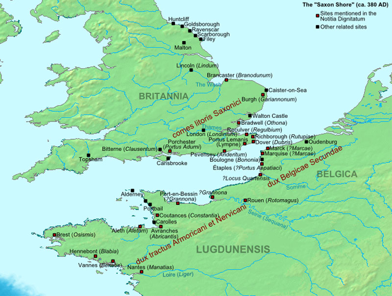
The late Roman  coastal defence called the Saxon Shore, stretches from the English Channel coast, around East Anglia, and then  intermittently northwards ending abruptly at Huntcliff just south of the River Tees,  a  sort of Roman version of the WW2 Atlantic Wall apparently to deter against 4th century seaborne incursions.

Saxon Shore Defences

As per usual with archaeology it is somewhat of a gilded lily, because the current archaeological evidence for any sort of  cohesive defensive system is patchy indeed, and when it comes to hard evidence we have  a mixed bag of sites too far apart to be any sort of cohesive integrated system,  with few  literary references.

What exists in physical terms are a series of substantial forts built or reoccupied lining the coast from the Isle of Wight around the Dover strait and Thames estuary to Caistor on Sea in  Norfolk. After Caistor  we have an apparent  100km coastal gap before the fort at Brancaster on the edge of the Wash, then  a 150km coastal gap through Lincolnshire to the postulated naval base at Brough on Humber some 50km up the Humber Estuary.  The first of the North Yorkshire Coast signal stations is at Filey  130km along the unprotected east Yorkshire coast and Humber estuary, with  finally a 60km coastal gap between the most northern signal station at Huntcliff and Arbeia at South Shields on the Tyne, a Roman naval station at the end of the occupied forts of Hadrians Wall.   A total distance of some 440km of undefended coastline  with a dozen major river estuaries, not so much a Saxon Shore defence, more like modern EU Border Control.

Of course it is not that simple!

Coastal erosion in Norfolk, Lincolnshire and East Yorkshire are quite likely to have swept away defences over the intervening 1600 years, however coastal erosion is perhaps not quite as convincing for the apparent absence of sites in Durham with its magnesium limestone cliffs.    With a general  elevation above OD of about  35-40m  between the Tees and the Tyne, there should be some evidence to find.  The apparent absence of coastal Roman sites in Durham may well be  the legacy from extensive coastal deep coal extraction over recent centuries,   and the extensive dumping of carbiniferous coal waste over the  shoreline and the  cliffs,  as well as the notorious sea dumping via  trolley systems as evidenced by the film ‘Get Carter’.

Ignoring minor estuaries we have 1000km of coastline between the Isle of Wight and South Shields. What we have surviving and discovered are  a series  of manned forts stretching from the south coast  upto Brancaster in Norfolk,   apparently without any  signal stations or smaller forts  between them to provide warning of incursions in the  20km + gaps between them, and  a series of signal stations in Yorkshire between 11km and 20km apart, apparently without any forts in the vicinity to warn.

To use an old north east term. ‘There’s rabbit off somewhere’

It is for others to look for evidence for small forts and signal stations in the Saxon Shore south east, my research  is looking for the missing military sites that give some coherence  to the existence of the signal stations. As it stands the  5 stations were  probably manned by 10 men each, providing a force of 50 men to defend a 75 km coastal strip,  who with our current narrative were probably reduced to lighting fires, shouting rude words  and baring their backsides at the invaders from their cliff top towers to try and scare them off.

The North Yorkshire Coast

The North York Moors (NYM) plateau  stretches west to the Vale of Mowbray, north to the edge of the Tees Valley, and south to the Vale of Pickering.  Unlike the nearby Yorkshire Dales  which gradually  lose elevation as  they  leave their  watersheds, the NYM are a high plateau. The highest point of the NYM is 450m OD  reducing to around 250 to 300m OD across most of its  area before dropping down steep scarps 200m in the space of 2-3km to the rivers and  vales below.

The North sea coast is no exception,  from Saltburn in the north to Scarborough the sea cliffs of the NYM plummet near vertically into the sea. The highest point at Boulby is some 203m(609ft), which can be put into perspective against the notorious Beachy Head, the highest point on  the white cliffs of the channel coast,  which at 162m (531ft) is a mere pussy cat of a sea cliff in comparison.

With such massive cliffs in Yorkshire why did the Romans need defences there?

Whilst the sea cliffs are formidable they are also serve as an eastern watershed for the moors, with  several natural  harbours and bays along their length from  Skinningrove in the north through Staithes, Runswick Bay, Whitby, Robin Hoods Bay, Scarborough, Filey to  Flamborough in the south. It is these natural harbours that perhaps offer us a clue   to the purpose of the signal stations.

There are two schools of thought.

  1. They were monitoring the movement of coastal traffic,  but to what effect,  There was  presumably trading up and down the coast for centuries before the signal stations were built, with apparently no reason to monitor the coastline or the coastal harbours.   After the abandonment of the fort at Lease Rigg and camps at Cawthorn in the late 2nd cent, we have a near 200 year gap before military sites reappear in the form of signal stations.   If we consider the signal stations as  part of   principally a naval operation, and even if  we assume signal stations extended through Durham and down to Brough, how could they offer any defence or warning against an incursion along the coast, or inland  through a major river like the Tees.

2. The second school of thought makes an assumption that the signal stations signalled inland to a garrisoned position for support, with the fort at Lease Rigg above Whitby as the oft quoted fort of choice.  The problem with this theory off course is that the signal stations came into existence  post 350AD, and the latest date that can be currently ascribed to the fort at Lease Rigg and the camps at Cawthorn is in the region of 180AD. Even the Roman provenance of Wades Causeway has been questioned in recent research by Historic England.   If  the signal stations were signalling inland two hundred years later, it would seem logical to expect them to  re-use or expand  these known sites with existing defences, yet that does not appear to have happened.   The nearest known contemporary forts would be at Malton some 32km away, and York and the line of later forts along Dere Street  some 50-60km away, and that is as the crow flies. A large garrison at a fort at Lease Rigg could in theory contain an  incursion at Whitby, Staithes, Runswick Bay, Robin Hoods Bay, and Skinningrove, but these sites are between 10km and 18km away as the crow flies, it would probably take half a day for a unit to mobilise and get to Whitby 10km away, not exactly fighting them on the beaches.

Summary:

If we discount 1 and 2   for lack of supporting archaeological evidence, then the only  working theory  that can be arrived at is that the signal stations were part of some linear coastal defence in depth  using a series of garrisoned forts,  on or in close proximity to the coast, supported by early warning from the signal stations on the high cliffs, and close enough together to allow for garrisons to work together to provide a larger force to deal with any given incursion,. whilst having the signalling ability, either visually or by messenger  to communicate to the larger forts and fortresses inland.

If you have read so far and come to the conclusion that here we have another airy fairy theory, ignoring the millions of words of academic research on the late Roman Army, academic research perpetually based on re-analysis of the existing data.

The status quo is ridiculous, there has to be other  type/s of Late Roman  military site of non standard design, or no design,  bigger than a signal station, but smaller than  an auxiliary fort.

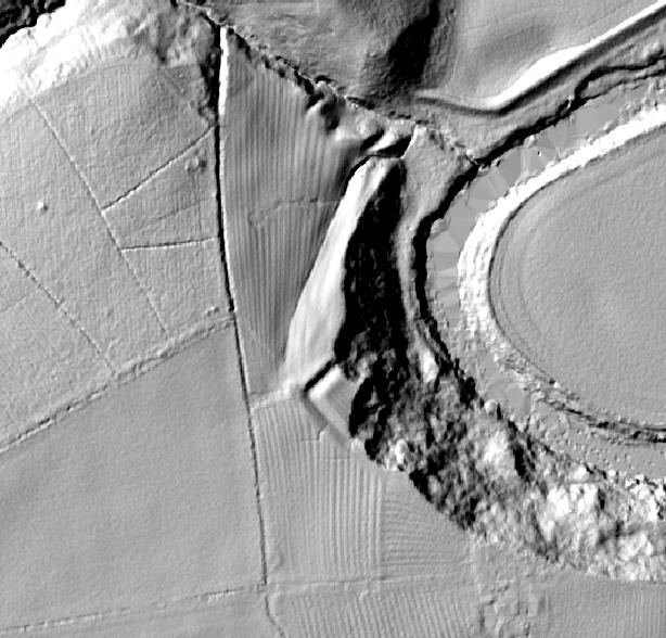
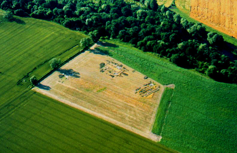
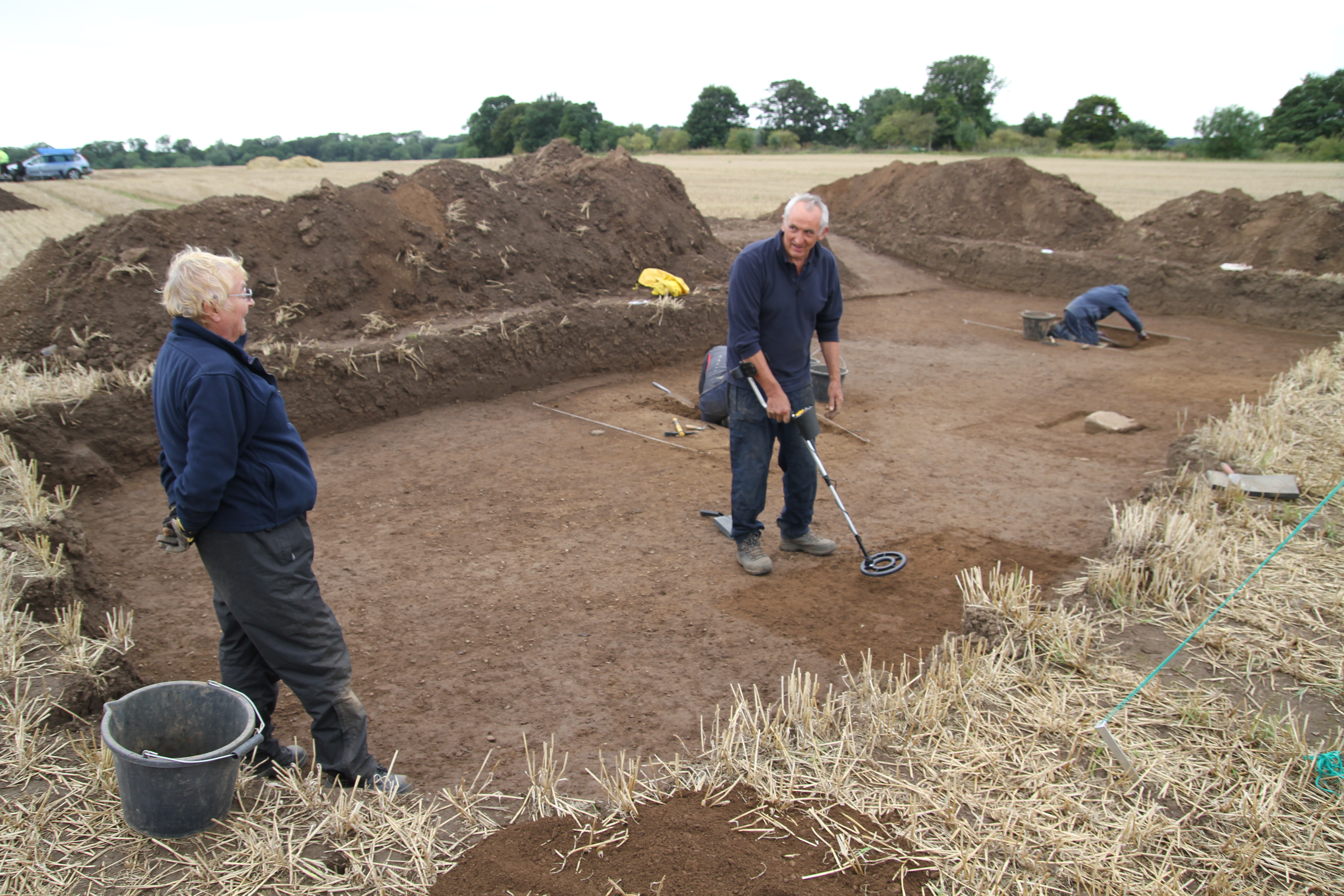
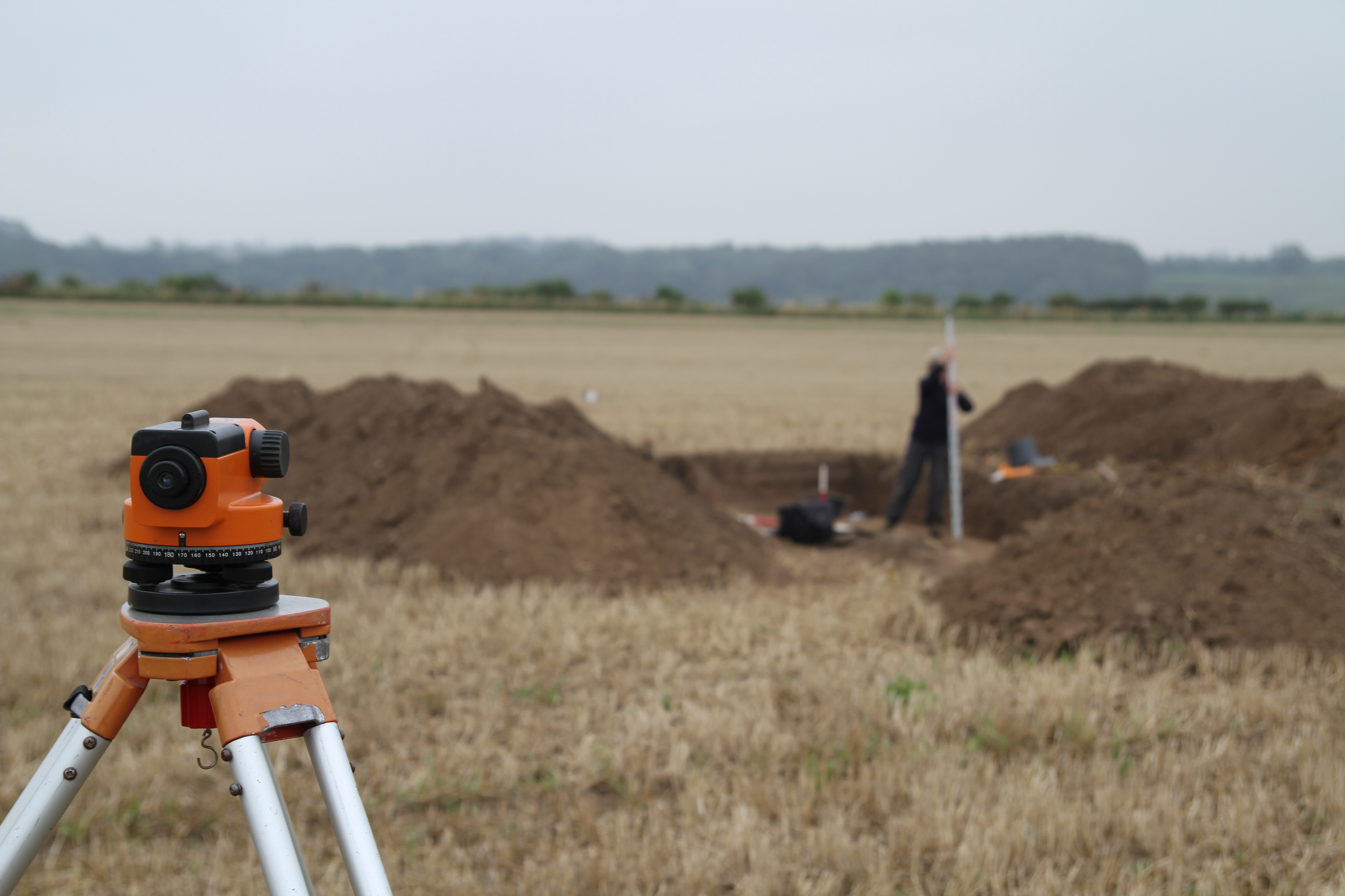
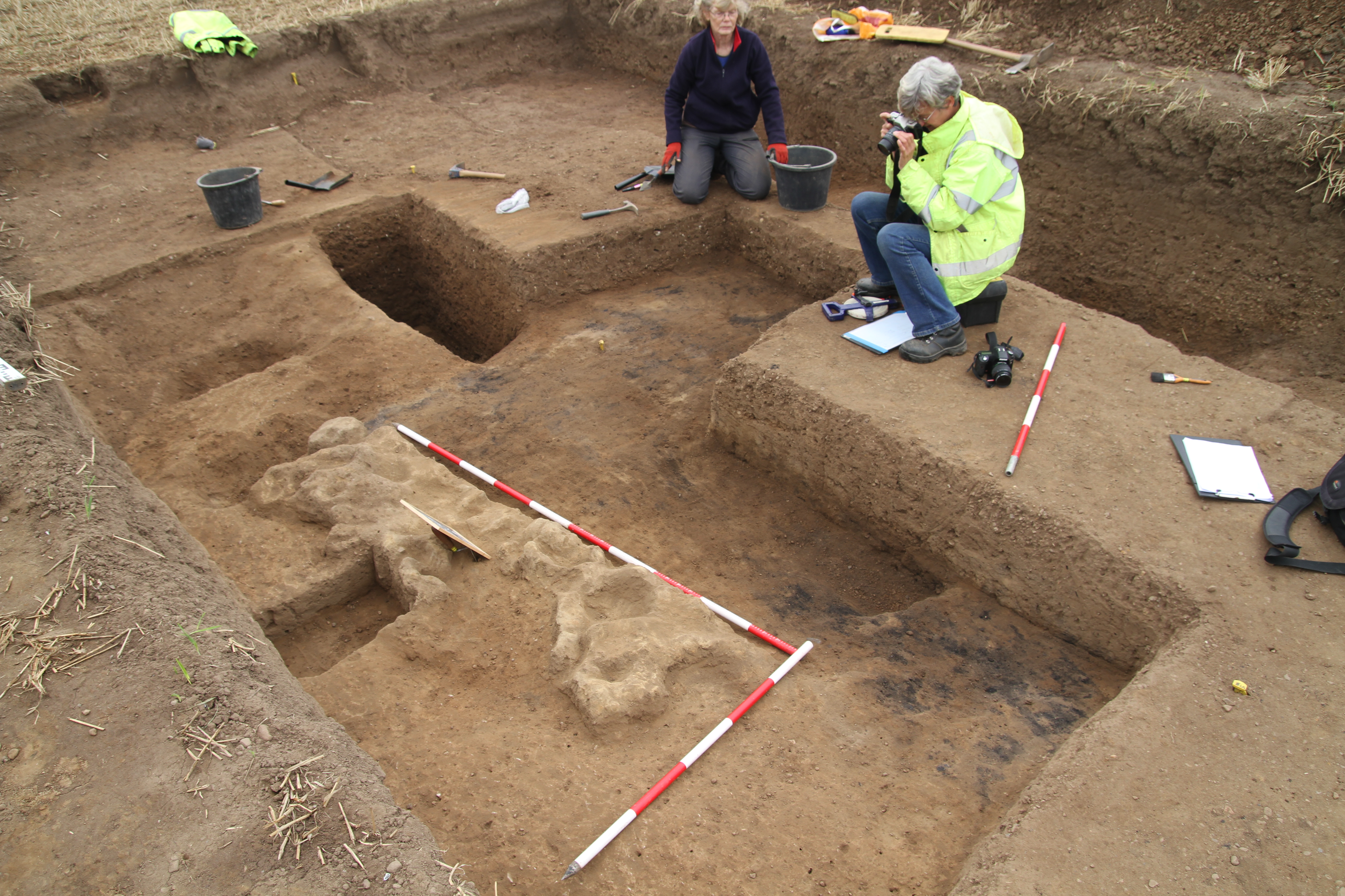
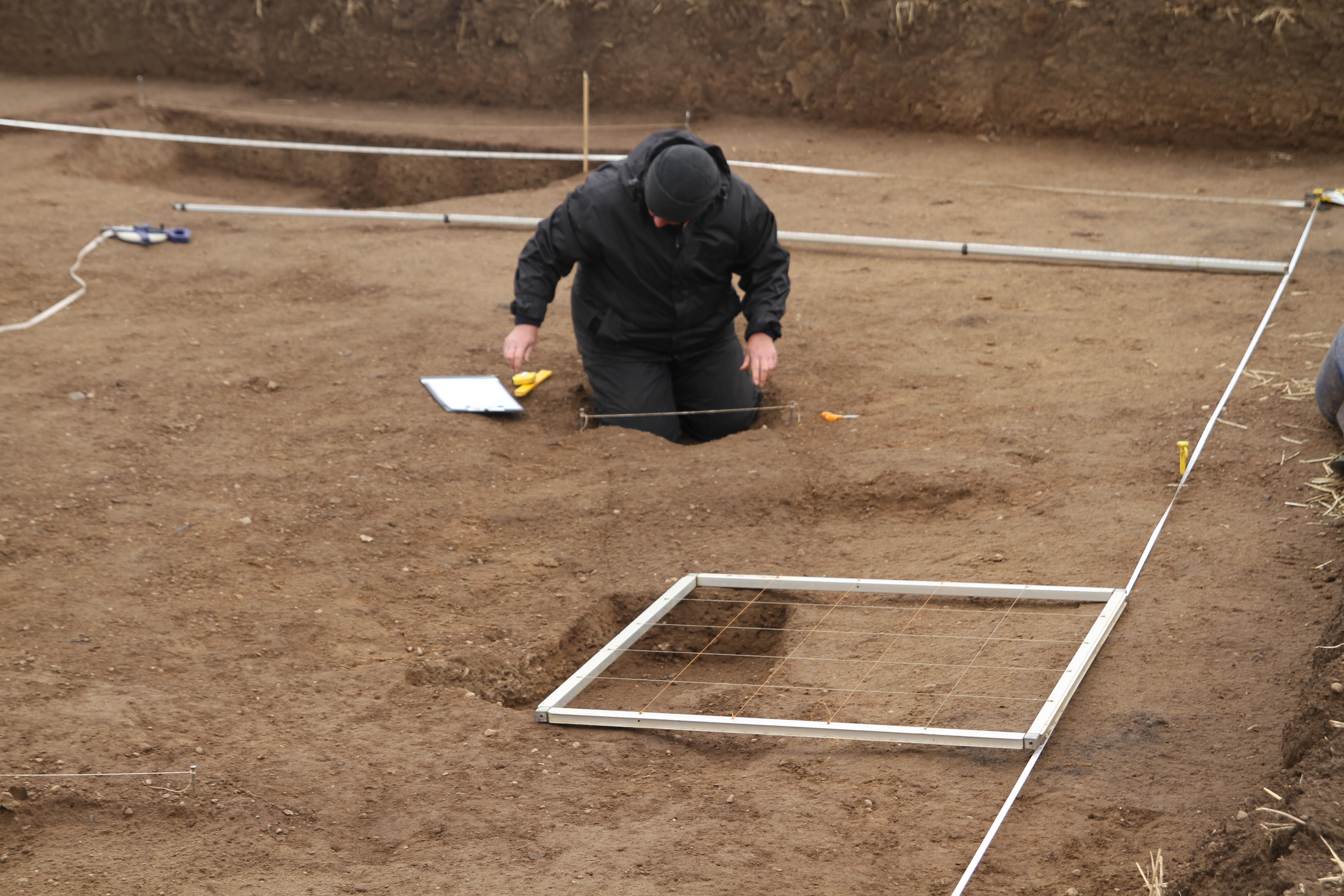
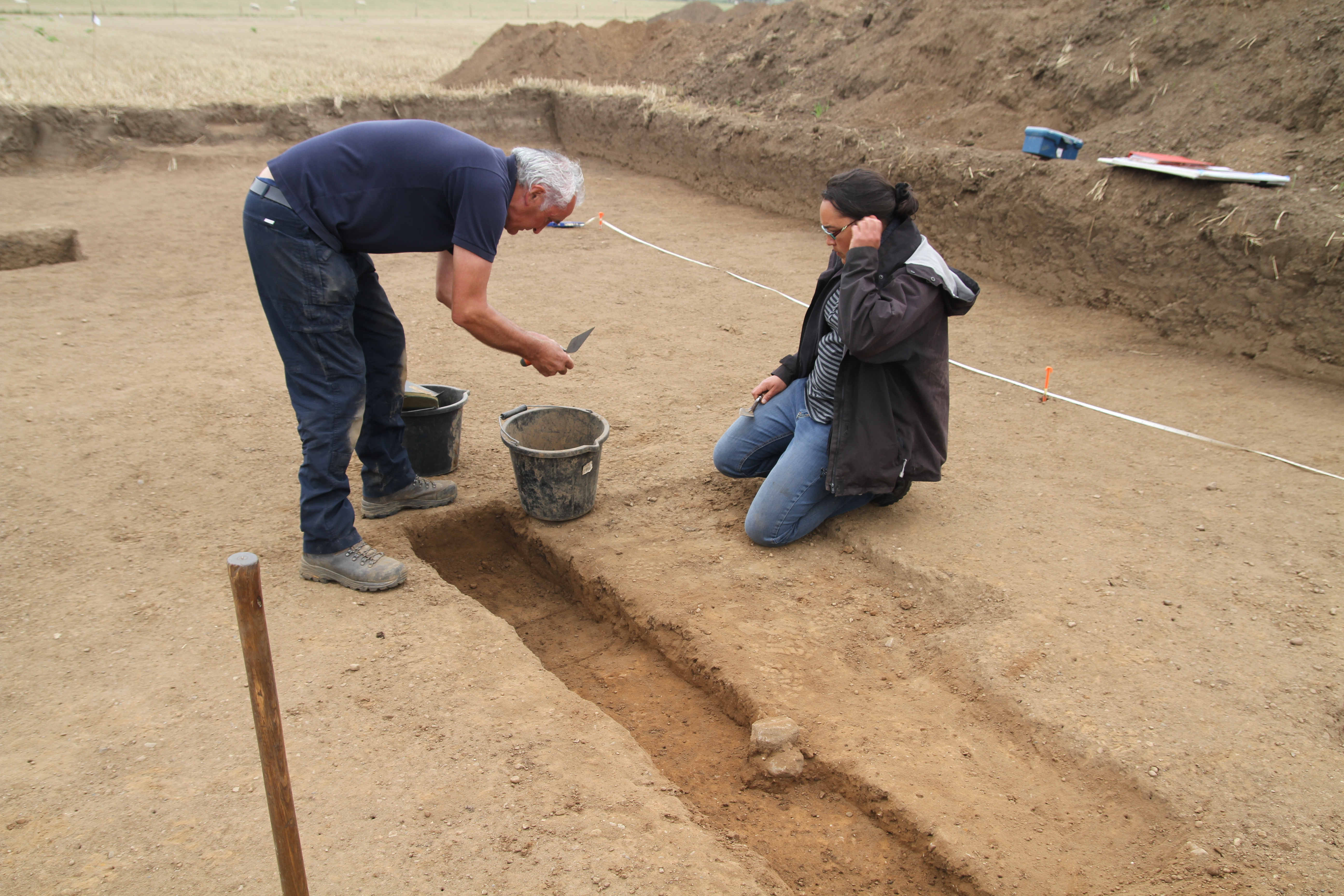
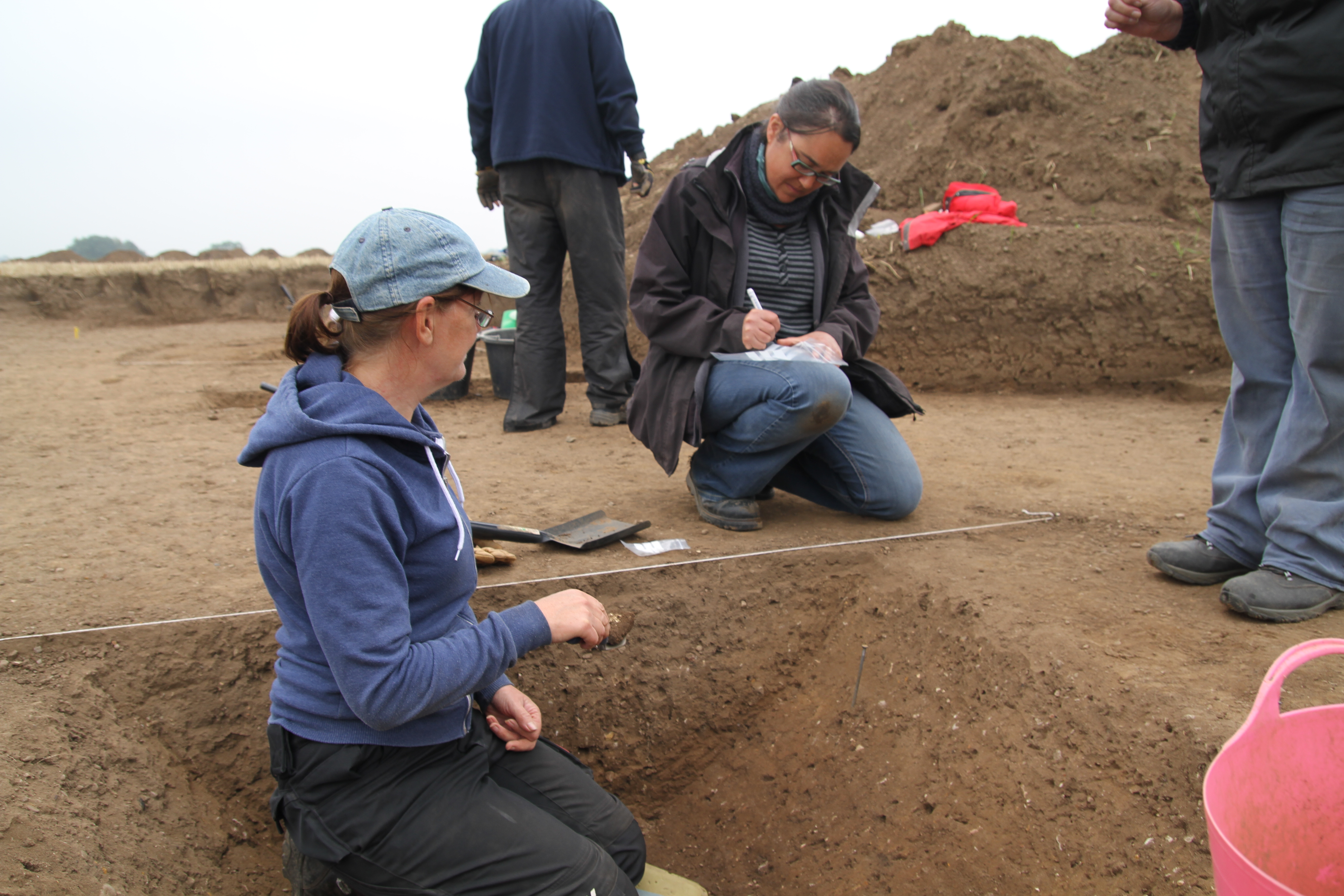
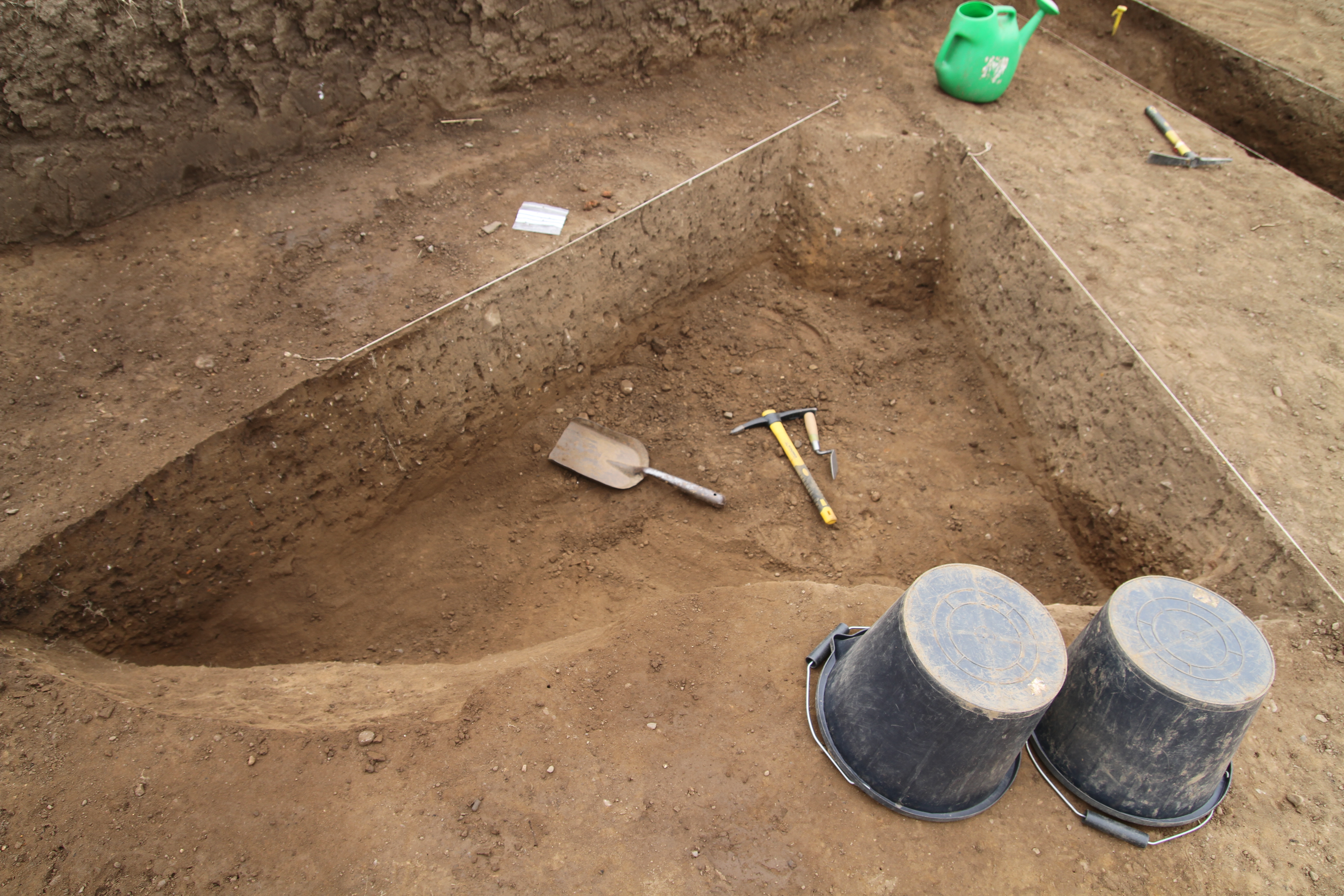
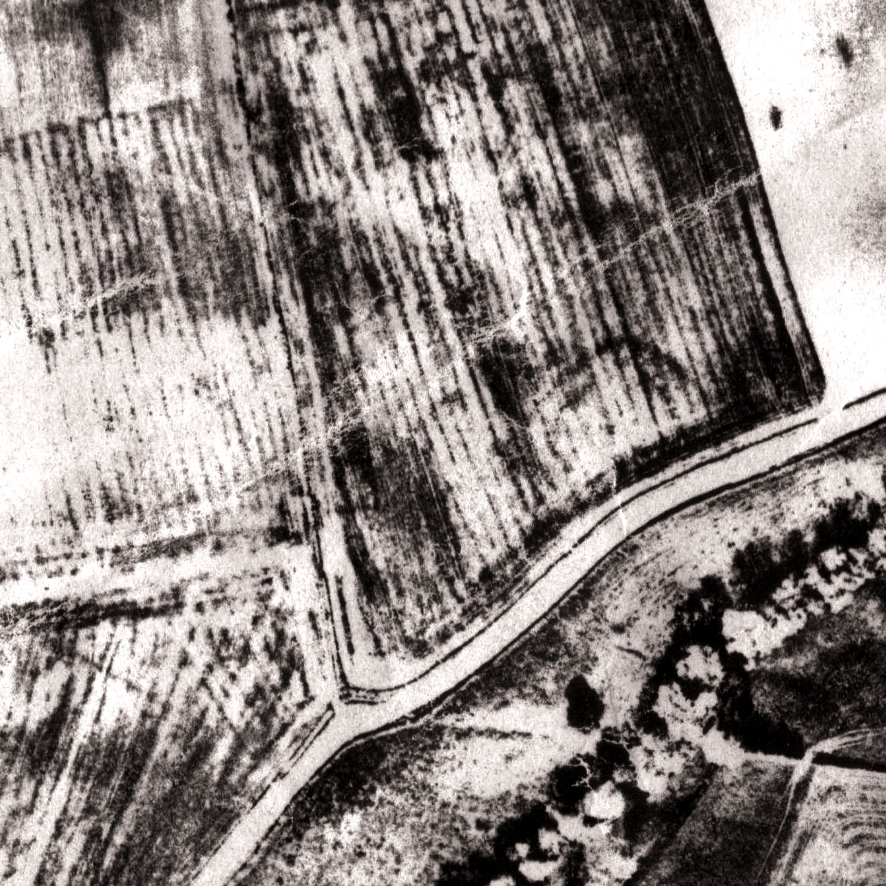
One of the central themes of our project is revisiting all the regional AP archives with a view to identifying sites hiding in plain view in the < 100m x 100m(1Ha) range , that had the potential for post Roman  use as small enclosures.   Our project is currently  locating such sites within the Tees Valley, and currently has  9 candidate sites for further field investigation.  One has had a small investigation of a ditch section, where we  found a ‘V’ shaped ditch, a few sherds of early Roman pottery and 100 pieces of 3rd and 4th century Crambeck and calcite  gritted wares. This work will continue over the next couple of years


Dalton on Tees Romano British Villa (Chapel House Farm)

In the early 1990’s a fieldwork group was set up within the Teesside Archaeological Society, led by myself with a view to investigating the apparent absence of Romanisation in the Tees Valley after the 2nd century.

The project focused on revisiting archive material,  and approaching those carrying out funded and unfunded aerial photography with a view to reassessing those images that had been archived under the catchalls of Iron Age and Medieval enclosures,  and field systems.

Two particular sites were brought to our attention by Blaise Vyner who had been conducting funded AP surveys of local sites for many years,  for the official archives. He postulated a ‘cottage house’ early form of villa feature at at the top of the scarp above the river at Dalton on Tees, 5km  south of Darlington. Additionally a small enclosure at Hardstones Farm, Long Newton 5km west of Stockton on Tees, positioned on the eastern end of the ridge on which the postulated alignment of Cades Road (Margary 80A) traverses the Tees valley at the other end, some   1km to the west.

The Dalton site was visited,  where it was immediately apparent that the structure was in the cultivation horizon  with heavy concentrations of ploughed up stone in the field margins on the scarp slope, together with  plaster, tile and other materials  present in the top soil.  A series of field-walking exercises working to a 20m grid were carried out over the course of 1994/95 between crop cycles, and a clear plan of the probable limitations of the Roman site were gained from the plotted pottery scatters.

it was decided that in 1997 after the harvest,  we would carry out limited excavation down to the last occupation surface to establish the level of plough damage, and record what we could before they were subject to further damage or destruction.  It soon became apparent that the task exceeded the window available,  especially considering we were relying on 100% hand excavation.  We contacted Henry Owen-John of English Heritage, who after visiting the site kindly agreed to provide the funds to compensate the farmer for taking the area we had identified out of production for a full year, just in time,  as the rest of the field was deep ploughed for potatoes.

Our project design was simply to expose and record as much  of the last occupation layers as was possible,  of what we thought at this stage was a single winged corridor villa some  30m x 18m. We worked through the autumn and winter of 1997/8, and the spring and summer of 1998, working every weekend whatever the weather. before handing the site back to the farmer Mr John Ramsden and his lovely wife Anne.

We eventually exposed two large buildings, Building A the winged corridor building 30m x 18m to the east.  The principle structure  facing south was Building B, a winged aisled building ,  probably two storeys of exactly the same 30m x 18m dimensions  as Building A, , together with a third range Building C some 20m x 10m to the west, and additionally a  well.

After magnetic and resistivity surveys,  we were presented with a huge four ditch system running between the two primary buildings with the two principal ditches 7m wide.  We decided to section one of the ditches to collect a stratified deposit, and recovered a wide range of stratified dateable material  spanning  the 1st century to the end of of the 4th, We also excavated the  well we found adjacent to  Building C.

An area including all the buildings was recommended for scheduling and was duly scheduled in 2003.

This classic villa complex at a stroke moves the extent of the developed villa landscape north  40km from the Vale of Pickering to the banks of the Tees, and has created a re-evaluation by others of other sites categorised as discussed above, as well as encouraging others to actually look for Romanisation. This has resulted in another villa on the banks of the Tees at Ingleby Barwick 14km east of Dalton, and another villa at Brotton in East Cleveland to add to the existing villa at Holme House, Piercebridge, which was formally thought to be linked to Piercebridge, rather than being  a standalone villa. Other sites are also under research.

The full excavation and specialist reports for the Dalton on Tees Villa will shortly be published on this site within  the Open Archive, and soft copies will be provided for the national records and other interested parties. There will be no printed version. The excavated material is under archive at Tees Archaeology.

On the 27th June I gave a presentation in the Dalton on Tees village hall about the villa and our wider project, now under the auspices of the Mid Tees Research Project, in aid of raising funds to support the  village hall. The PowerPoint presentation I gave is below, obviously without comment.  It is our intention to  shortly index my audio of the presentation to the Powerpoint, and present it on here  as an audio type book,

Romanisation of a Valley


Looking at a Roman site and up pops a Lower/Middle Paleolithic hand axe.

When I said archaeology had to take a back seat,  what I really meant was that archaeology had to take a back seat from being all consuming. The problem is the more you look, the more you find.

Mooching around one of my  postulated Roman enclosure/small fort sites,  which lies on alluvium and glacial sand and gravels, up pops this hand axe. No expert on prehistory but it seems to fit anywhere from the  Acheulian 0.5 million years ago, upto the Mousterian, as recently as 40,000 years ago.  I’ll leave to others to nail it down.

Interesting item, roughly 100mm (4″) x 75mm (3″), and has a edge worked from either side, which has created a rudimentary saw blade  effect. Fits beautifully in the hand even to the notch for the thumb to grip it.

if anybody is interested in further info or to have a look at the axe, drop me a line.

SAMSUNG DIGITAL CAMERA

SAMSUNG DIGITAL CAMERA

SAMSUNG DIGITAL CAMERA

The Great North Road

A major part of our project is understanding the significance of Cades Road(Margary 80a), the eastern  twin of Dere Street running north/south through the Vale of York.

Often in  focusing on a defined historical period for research, it is easy to become out of sync with that which went before and after.  Most will  have heard the urban myth of the A1 being on top of  Dere Street on its route through North Yorkshire and Durham, but is that actually true.

The Roman road Dere street is  a Roman military road hugging  the eastern side of the Pennines through our research area,  transecting  the entrances to the upper Yorkshire and Durham Dales.

After leaving Catterick on the Swale and passing Scotch Corner the  start of  the east/west route across the Pennines,  Dere St leaves the alignment of the  modern A1, and slowly begins  its climb to an elevation of upto 260m as it moves increasingly west.

The road connects   a  series of Roman forts in west Durham, Piercebridge on the Tees, Binchester on the Wear, Lanchester on the Browney,  Ebchester on the Wear, arriving at the major Roman supply depot at Corbridge on the Tyne, centrally positioned  to supply forts on  Hadrians Wall both to the west and east. Was it built  to create a  line  of forts, controlling the high Pennines, or to protect a strategic supply route. Perhaps in reality it was a bit of both.

Dere St- Great North Road- Cades Road

It would appear  once its military purpose ended in the early 5th century, whilst probably remaining in use as west Durham local road, the next time we see the road as a published route in the medieval period, where it is recorded only as a route to Scotch Corner for  access to the east west route across the Pennines.

To the north of Scotch Corner,, the focus of medieval settlement   is in  the productive lowland  areas and coastal plains, and the strategic routes followed.  On a purely practical level as a strategic route, the course of Dere Street in Durham was always a road to knowhere, once Hadrians Wall went out of use,  subject even today to winter inaccesibility, and once north of Hadrians Wall a journey to Scotland would have required navigating  across the equally inhospitable and at times inaccessible high Cheviot border country.

Gough Map 1360
Gough Map 1360

What is  interesting is that if we take the Yorkshire stretch of Dere Street, and the Durham stretch of Cades road, join them with a wibbly wobbly bit of the Great North Road, and we end up with the A1 route pre-motorway upgrades

I would now like to  introduce an excellent piece of unpublished research on the Great North Road by Hugh Gillespie.

The Great North Road (H R Gillespie)

I bumped into his website  by accident which has a selection of chapters available online to read. I approached Hugh who kindly provided me with the chapters relating to Yorkshire and Durham, and gave me permission to publish them on the blog. They offer a fascinating insight into the development of the modern road system.  Of particular interest to me  is the reality  that the link between Dere Street the Great North Road and the A 1 is quite recent in historical terms, contrary to what many of us believe, as recently as the 1920’s when the road system was named,  the road we know as the A167 Topcliffe  to Darlington road through Croft was actually designated the A1 for two years before it was transferred to Leeming Lane which we know  today as the A1.

Fascinating reading, cracking research,

Thanks again to Hugh.

Great North Road History 1. Chapter 1

Great North Road 2, Chapter 7 (Doncaster to York by  eastern route)

Great North Road 2, Chapter 8 (York to Northallerton)

Great North Road 2. Chapter 9 ( Doncaster to York by eastern route)

Great North Road 2.Chapter 10 ( Brotherton to Northallerton)

Great North Road 2, Chapter 11 ( Northallerton to Darlington)

Great North Road 2.Chapter 12 ( Boroughbridge to Darlington via Scotch Corner)


Rural Settlement in Roman Yorkshire Conference thoughts!!

I attended the above conference at the Milton Rooms in Malton last Saturday, organised by the Roman Antiquities Section of the Yorkshire Archaeologial Society and The Society for the Promotion of Roman Studies (The Roman Society)

It has to be stated that the conference was to some degree spoilt by the woeful quality of the PA system which seemed to consist of a couple of speakers from somebodies old HiFi that couldn’t deal with the output of the amplifier, an amplifier that spent most of the day either on the verge of distortion, or doing a Norman Collier impression by clipping the output,  fronted by what seemed like an oki koki 3000 microphone nicked from a  chidrens karaoke machine with awful frequency response.

Most of the speakers were to some degree affected by the quality of the PA, at least one had their talk ruined in my opinion,  only the predictably loud Dominic Powlesland  abandoned it all together and went vocally commando to do his talk on West Heslerton that replaced the original talk on the Aiskew villa. . Surely it is not beyond the wit of organisations where public speaking is at the core of their function, to either pick a venue with decent sound equipment, or spend a few quid to buy a portable system themselves.

It was encouraging that two of the talks were from amateur groups working in Yorkshire. The Roman Roads project was presented by Mike Haken who came up with some interesting ideas regarding settlement along the major routes, and the Swaledale & Arkenga thdale Archeaology Group(SWAAG) presented an interesting talk on their work in their valley.   Steve Sherlock gave a talk on the A1/Catterick road improvements,  Steve had  that much to talk about that the 30 mins slot was just not enough. Archaeology on another scale!

Prof Martin Millet and Dr Peter Halkon both gave their usual professional and interesting talks about their  work in East Yorkshire.

Dr Pete Wilson gave a talk on behalf of  Dr Martyn Allen on  data syntheses from the national Roman Rural Settlement project, aimed at collating and analysing developer funded projects since the advent of PPG16 legislation around 1990.
Although all of these developer interventions are recorded on the HER, few have been formally published, strangely the cut off point for this work was indicated as being 2004, and seemingly excludes anything that is not developer funded,  which in effect makes the work already 11 years out of date, and incomplete.
This built in obsolescence was exampled when Pete presented a map of the various types of Roman settlement, where the evidence for  the extent of the Roman villa landscape  appeared to be that from pre- 1995 with Holme House at Piercebridge being the only ‘villa’ indicated in the Tees Valley. It does question the validity of the research if the Dalton on Tees  and Quarry Farm ingleby Barwick  villas, both research led investigations, and both on the national monument record since before 2004 are absent.
One would presume if you are calling a data synthesis project Roman Rural Settlement, that it would record all Roman Rural Roman settlement , and not just Roman Rural Settlement that conforms to an abstract project design. The key is in the title, Roman+ Rural + Settlement.
Interesting conference though also bumped into one of my old tutors Professor Jenny Price.

The Piercebridge Formula Revisited.

When writing the Cades road background for the Pountey’s Bridge post, I noticed in the image provided for me by Rolfe and Bob,  standing in the middle of the river was the person that the archaeological community at the time considered the devil incarnate, to be ridiculed, insulted and generally brushed aside.

That man  is the late Raymond (Ray) Selkirk, author of the Piercebridge Formula and  On The Trail of the Legions.  I never met Ray myself, and although we were both looking for missing Rome in the north east in the late 1990’s, Ray was coming to the end of his amateur archaeological career, whilst I was just beginning mine.  However if I   share anything with Ray Selkirk, it is the same comittment to always challenge the status quo,  especially the cosy world of concensus  archaeology.

Ray Selkirk 1931-2006

So why was this man so reviled by the archaeological establishment?

What was his archaeological crime, was he a north eastern equivalent of Erich von Daniken, touting the theory in his book Chariot of the Gods,  that God was  a spaceman, or was he perhaps the equivalent of those who for religious reasons are committed to the idea that a  fossilised Noah’s Ark is sitting on a hillside in modern Turkey.

Nope!! The archaeological community thought Ray was apparently  far barmier than that, what Ray actually wrote about in the Piercebridge Formula was  the idea that the Romans might have canalised rivers such as the Tees to transport goods upstream to places such as the fort at Piercebridge.

Romans building canals?  Surely not you might say, what a ridiculous idea, who would use rivers and canals for transport purposes?.

Well just about everybody actually!

Of course the Romans did build canals, and the Greeks before them,  why wouldn’t they, they built huge numbers of them.  To suggest that they would not engineer rivers to serve them in Britain if necessary is chutzpah of the highest order, especially from a community that collectively are not exactly known for their engineering prowess.  Yet with one or two big names sticking the knife in,  most just hunkered down to progress their careers by  not making waves, whilst Ray was subject to intellectual evisceration.

Roman and Greek canals.

Of course when it comes to airy fairy waffling on archaeology, the establishment,  including the great and the good who today fill  our TV screens,  take some beating themselves.  With their ‘sites of ritual significance’,  ‘ processional ways’ ,  ‘high status buildings’, high status, this, high status that, ritual this, ritual that. Anybody listening to popular archaeology as defined by the establishment would think the whole population through unrecorded and recorded history was composed of middle to upper middle class types, only living in the equivalent of 5 bedroom detached homes with on-suite facilities, spending all their time when they weren’t doing high status things. building churches, walking from one church to another in their best clothes,  in between praying, sacrificing, and votively offering all sorts of things.

What really was the archaeological crime committed by Ray Selkirk, I would suggest he was on a hiding to nothing by postulating a theory in advance of finding definitive supporting archaeology.  The archaeological community in academia can get away with all sorts of theoretical gobbledegook, but an amateur archaeologist does not have that luxury of independent thought, if they expect  to be taken seriously.   Ray should have known that, and should have tempered his book accordingly, the confidence Ray had in  his idea, which is a perfectly logical area of research in my opinion, became  in the Piercebridge Formula a statement of fact rather than a theory.

What now for the idea of  canalising  rivers such as the Tees.?

For the archaeological establishment any attempt to revisit the idea will be forever linked with Ray Selkirk and avoided like the plague,  probably leaving any future research that might take place to amateur groups.

Well I was told there were no villas in the Tees Valley, until we found one, I was told that all the military activity took place  through  the Dere St corridor, until we found Roman camps and settlements on Cades Road where they weren’t supposed to be. There are apparently no small Roman towns in this area, well watch this space!

When Ray Selkirk wrote the Piercebridge Formula there was only Piercebridge to  support his reasoning,  now we have  a Roman military and civilian landscape along the Tees, from the villas at Dalton on Tees and Ingleby Barwick,  Cades Road at the tidal limit, and adjacent to the tidal limit  we now have Roman camps and  civilian settlement.

Perhaps it is time for the Mid Tees Research Project to revisit  Ray Selkirk’s ideas, to bring  him in from the cold.

Pountey’s Bridge

Pounteys Bridge Investigation

Rolfe Mitchison and Bob Middlemas

1991

( additional Cades Road research by John Brown)

Pountey’s Bridge and the Tees crossing point of Cades road is  the classic chicken and egg scenario.  An enigmatic roman road lost to history needing a crossing point,  and a bridge looking for a road to cross it, put the two together, a touch of imagination and everything is a possiblity.

Pountey’s is but  one manifestation of the name which simply means Pons(bridge) and teys(Tees). Bridge of the Tees.

The earliest name and reference is  circa 1200, and with  Leland failing to mention it in the middle of the 16th century it would seem by his time it had already gone out of common use.  Perhaps a  more accurate  indicator of its demise, can be gleaned from the known  presence of a hermitage on the bridge under the control of the prior of Durham, who made the last appointment to this hermitage in 1426, after which there is no further reference

Hermitage on Pountey’s Bridge

That there was a bridge at Middleton One Row there is no doubt, and  a bridge that seems to pre- date the bridges at Yarm  built by Bishop Skirlaw in about 1400, and the current bridge at Croft also built in the 15th century to replace the  earlier wooden bridge destroyed by floods.   The question is what evidence is there for linking Pountey’s bridge to the Roman period as a crossing point of Cades Road(Margary 80a),  and when was the link made.

Cade’s Road(Margary80a) is named after John Cade of Gainford, an 18th-century antiquarian who in 1785 proposed its existence and possible course from the Humber Estuary northwards to the River Tyne, a distance of about 100 miles (160 km). Although evidence exists for such a road on parts of the proposed route, particularly through North Yorkshire, there is considerable doubt regarding its exact course and where it crossed the Tees. The road’s Roman name is unknown, although Cade referred to it as a continuation of Rycknild Street.

Cades route begins at Brough-on-Humber the site of a ferry, a Roman fort and civilian settlement (Petuaria) alongside a major Celtic settlement. He suggested that it ran northwards through Thorpe le Street and Market Weighton, before gradually turning westwards (possibly following the line of another Roman road) until it reached York (Eboracum). From York it continued northwards, skirting the edge of the Hambleton Hills towards Thornton-le-Street near Thirsk, and then north  just to the west of the massif of the North York Moors.  Approaching the Tees the  12km extant alignment of  hedgelines and country lanes evaporates into thin air just 800m from Fardeanside Ford a crossing point into Newsham in the parish of Egglescliffe one of the principal crossing points of the Tees, even after the building of the road bridges at Croft and Yarm. After crossing the Tees Cades route takes the road north to Sedgefield, Durham, Chester le Street, before finally terminating at Newcastle.

Cades Road looking south from the Tees. The Fardeanside Ford is at the junction of the ploughed field with the hedgline.
Cades Road looking south from the Tees

It is at this point on Cades deliberations, where common sense and logical thinking seem to have left the building, in preference for the if’s, but’s and maybe’s of antiquarian thought.

John Cade was  a  local man from Gainford, and  the area along the 100 mile route he knew  most intimately was where he was now trying to solve a conundrum.   Accepting that he was party to the view that Roman roads were generally straight between given points reflecting the topography of the landscape, logic would have suggested that crossing the adjacent ford, would allow the route to continue in a more or less straight line towards the point where the route becomes  evident in the landscape again at  Sedgefield. The problem for Cade was that a crossing at the ford was not supported by evidence of archaeology, no Roman camp, no earthworks, and perhaps more importantly no clearly defined straight alignment  to the north.

Did Cade therfore jump at Pountey’s bridge as his crossing point?

Well no he didn’t!

Cade didn’t choose Pountey’s because he presumably   knew that in 1785, there were numerous mentions of Pountey’s bridge as being medieval, it was not until the 1820’s, that for the first time the bridge is mentioned as Roman.

Cade also had another candidate, just 2km to the west in the longest  loop of the Tees  that extends some 4.5km from the median line of the river south into the North Riding of Yorkshire lay the ancient site of Sockburn(Soccieburg). A defended ancient site by its name elements, the site  where all the  new Prince Bishops would  formally  enter the county of  Durham, the site of the famous Sockburn Worm legend, an ancient church with Viking hogbacks and Anglo Saxon crossshafts aplenty.  Sockburn, together with maps already ancient by 1785 showed  a road north out of the peninsula joining with the straight road north to Sadberge at Middleton St George.  Cade presumably had enough circumstantial dots in his mind to join them up and neatly  extrapolate the  site at Sockburn back to the Romans.   In doing so Cade forced his alignment 2km to the west of its route through North Yorkshire creating a dogleg.  A single dogleg is perhaps not a problem,  and is common on roman road alignments, the  problem for Cade was that as he approached Sedgefield, he had to force the road back to the East by 2km to return to the alignment in East Park. This diversion created a  double dogleg, with not a pimple in the landscape to justify it, clearly against all the engineering practices common to the laying out of a roman road alignment.

Perhaps we should not be too hard on John Cade, he was after all working without the modern benefits of good maps and aerial photographs., we can perhaps be less generous with those who came later.

To anybody considering field research in archaeology, the logic of Cades double dogleg is a perfect archaeological example of putting two and two together and making five.  However Cades alignment set the baseline of the alignment, which in major part survives to this day. Cades route was subject to criticism within a few years of him  publishing it, but it was nearly 150 years before an alternative alignment at the Tees was suggested by OGS Crawford of the Ordnance Survey.

In the early 1920’s,   probably  based on  100 years of local folklore and surrounding the romanisation of Pountey’s bridge in the 1820’s, OGS Crawford suggested an alternative  alignment. The intervening century had generated  claims of a motte north of Pountey’s being a Roman camp, with  perhaps another Roman camp at Sadberge in the ‘roman’ field, he needed to look no further than Pountey’s Bridge. Without any more actual  evidence than Cade,  he suggested the road continued in a NNW direction and crossed at Pountey’s, before returning to Cades alignment.   Crawford although reducing the dogleg to the west slightly, like Cade did not address  the return dogleg approaching Sedgefield,

Despite the passing of 250 years since Cade, and despite numerous investigations, no evidence of Rome has been found at Sockburn or Pountey’s or on the alignment upto Sedgefield, apart from a few random  finds.

Subsequently Crawfords route, including Pountey’s was adopted wholesale by Margary in his definitive book on Roman roads, but still nobody questioned the bizarre logic of the doglegs, whilst 800m away across a simple ford,  hiding  in plain view was a Roman military site and settlement on the north side of the river, opposite the confirmed southern alignment, and exactly where logical thinking, topography, strategic value and common sense dictated it should be.

Cades Road Alignments


As the specialised divers in the amateur  Northern Archaeology Group , we led an investigation at the site of Pountey’s Bridge, with the aim of locating any remaining structure, and hopefully dateable artifacts to support the argument that Pountey’s was Roman.

Bob and I first got interested in Pountey’s Bridge in early 1991. This was due to the diligence of a Billingham historian called George Preece, who devoted many hours researching the subject. George told us that the bridge foundations were still visible in the river in 1823, and asked if we could locate them. He had already secured permission from the land owner in advance.

Our first dive was on the 4th May 1991,  when we spent 5 hours searching approximately 100m of river bed. We knew we were in the right area when we found pieces of worked lead, followed by a chisel, then an iron clamp,  clamps of this type were used to hold massive bridge stonework together, the lead was then poured in molten solidifying the joint between the iron clamp and  the stone. The lead would be chipped out with a chisel when the bridge was being dismantled.

Ponteys Bridge stone clamps

Our next dive on the 8th June 1991 produced a second iron clamp, and after digging down 300mm in the gravel bed adjacent to the southern bank, we uncovered the top of a large worked stone. This stone measured 550mm D x 750mm W x 175 mm H. We were happy we had  now located the remains of the southern abutment of Pountey’s Bridge, but were pleasantly surprised to discover that there was another layer of clamped foundation stones underneath this single stone.
Our next job was to find a pier, so we measured out 8m  from the face of the abutment and dug down into the gravel. After digging 450mm down, the stonework of the likely  pier emerged with quite an area of it still intact. The huge stones like the abutment were held together with iron clamps.
Over the next few weeks we completely uncovered the south abutment and found it to be 13.6m  wide  and  15m  deep.

Ponteys Bridge site plan
Location of Ponteys Bridge south abutment and pier adjacent to Church Lane, Middleton One Row

An open day was held in the September 1991, when members of our Northern Archaeology Group and the public, were able to wade across the warm river and observe the foundations, using glass bottom buckets.

Ponteys Bridge 1991 Public Open Day

After the open day, Bob and I reluctantly filled the excavations in and the bridge resumed its long sleep.
Bob and I have recovered approximately 5000 Roman coins and artefacts, plus buckets of pottery from the Roman bridge crossing at Piercebridge, in contrast we have not managed to find a single coin, artefact, or shard of pottery at Pountey’s of any period.  This absence of material may  be more a factor of the deep deposits of river gravels 2-3 metres deep across  the Pountey’s crossing site, perhaps in the future  investigating  down to the the bedrock, the secret past of Pountey’s Bridge will probably be found.

The investigation whilst perhaps not confirming  whether the bridge was Roman  not, has perhaps provided additional evidence  supporting a likely medieval date for the bridge . Traditional Roman masonry construction techniques used in   large  structures are  alternating  stretcher courses and header courses,  this has the purpose  of the header courses extending behind the facing stone, locking the stone face of the structure to the  core structure behind, and increasing the stability of the structure as a whole.  However the two courses of masonry exposed in the south abutment of Pountey’s are both stretcher  courses, there is  also  the absence of  Lewis holes in the stones for location and handling the material, also  very unusual though not unknown on a Roman structure.  Pountey’s Bridge was  a mystery,  and to some degree still remains a mystery, although we have perhaps shed some light on the issue.

Rolfe Mitchinson & Bob Middlemas.

Postscript.

Although this site is principally for research conducted by the Mid Tees Research Project, we are happy to publish other unpublished research by other organisations or individuals. If you have a piece of work  gathering dust on your shelves, send us a copy either peer reviewed or not, and we will add it to the archive. It is more important that raw data is made available to other researchers, even if some of the ‘T”s and a few of the ‘I’s remain uncrossed or undotted.

Please send any contributions to: john.brown@reiverenglish.com

Excavation Postscript

With the end of the excavation I will be ending the excavation daily blog or at least the perception of a daily blog. I will however continue the blog and develop the website going forward. I will also be publishing short interviews with a number of the  amateur archaeologists who dug with us, and  who kindly consented to being  video interviewed during the course of the dig. This project if it is about anything, it is about the people who enthusiastically carry out the work, and it is  at the core of the values and ethos of the Mid Tees Research Project that they are not simply shovel monkey’s to be used and  discarded at will, but a fundamental and integral part of the project going forward.

I want each and every one of them if they so choose, to have the opportunity once suitably skilled and experienced  to identify research areas of interest, and  to work independently  within the project  This project was founded by amateur archaeologists and will continue to be a beacon for amateur archaeological opportunity and endeavour.

Our sites are not recycled sites that everybody and their dog has talked about until the paint dries,  but brand new to archaeology  sites adding to the national archaeological story, all  found using minimal resources in the best tradition of amateur archaeology,  operating with an  open mind  receptive to all possibilities, exploiting the age old techniques of basic fieldwork,  coupled with the embracing of the vast array of open source(free) technology and data, with  the occasional quid quo pro arrangement  between like minded groups.

To end this stage I would like to thank all those who so far have contributed to our success, many   of which I will talk about their contribution in more detail going forward.

Landowner:

Where would we be without the support of the landowners and farmers. From my first contact with Brian Dale and his family , i have always found an interested and willing supporter of the project, obviously as long as it doesn’t impact on their commercial activities. Brian has been extremely acommodating over recent weeks at his busiest time of the year,  and for that we are very grateful.

Excavation supervisors:

Jenny Parker and Linda Davies hugely experienced amateur archaeologists on other peoples digs,  had their baptism of fire in leading on these excavations, and came through in fighting form. Nothing will be quite as intimidating again.

The volunteers: Many thanks to you all,  I will be linking the blog to a mailing list shortly, where you will all be informed of the current stage of the post excavation process, it will also be a conduit to inform  and advise of up and coming activity.

Graham Brown

Dave and Barbara  Dickinson

Rachelle Dale

Mike Dixon

Stephen Eastman

Gordon Ford

Bailey Fleming

Louise Gosling

Stephen Hutchinson

Cathy King

Jackie Kent

Allana and Grace McDonald

Barbara and Tony Metcalfe

Mel Partlett

Rob Scaife

Jackie Snow

Lorraine Watkinson

Sue Wilson

IMG_0429

Technology:

Mike Brown for website, imagery and videography

Anthea Ellis from the Jet Coast Development Trust for her  kind loan of the magnetometer on a quid  pro quo arrangement, where I supported their own geophysical activites and data analysis.

Blaise Vyner introduced me to oblique air photography, way back when, and kindly allowed me to accompany him on a number of flights. He was instrumental in providing me with,  and pointing me in the direction of likely sites that may be worthy of revisiting, Dalton on Tees being a case in poin.

Steve Kaye from Bandaarcgeophysics  from his base in the west country has shown a keen interest in the project since I first approached him regarding his data analysis on the likely location of Roman Marching Camps. Steve provided the project with enhanced LIdar imagery, advice and analysis, he has published online across a range of subjects.

http://www.bandaarcgeophysics.co.uk/arch/roman_marching_camps_uk.html

Rachel Graham and Robin Daniels from Tees Archaeology for their logistical support and offer of funding for 2015 from the River Tees Rediscovered Lottery funded project.


Day 11 no excavation or not much.

The site in the absence of volunteers seems quiet and reflective. Just Jenny, Linda and Rachel to finish off in advance of the digger arriving tommorow to back fill . I have turned up for the morning to hump and dump as required.

Tiny bit of excavation today opening up an area in Trench 4 above a couple of strong metal detector signals identified on the day the site was opened. This is another area where after cleaning down of the hard gravelly surface, no archaeological feature was identified, it was therefore assumed it was natural. and that the signals were probably ironstone, Breaking through the hard crust revealed a metal artifact which  subsequently turned out to be a large nail. This confirms that most of the archaeology is to a greater degree sealed below this material, a good starting point for our investigations next year.

Trench 4 location of large nail.

Visit to the site from the members of the local community in Egglescliffe,  informal arrangements made with Brian Dale the landowner to give a talk to the Egglescliffe History Group in due course.

Took the opportunity to extrapolate the line of the north ditch  westwards to its  return southwards near the scarp edge and outside of the arable area,  fixed permanent location markers, offering the project the opportunity to carry out further work if required on the marching camp at any time of the year.

Left the site at lunchtime to go and do some real work, leaving the ladies to finish off.

Asked for identification of this bird that flew into my car, with no takers all I can assume that archaeology and ornithology are not natural bedfellows.  The bird is a Meadow Pippit.

Meadow Pippit in mucky hand.

Excavation Day 10

Well time to cross the ‘T’s and dot the ‘I’s.

Last day for volunteers

Final burst of recording and environmental sampling of the primary fills in the ditches in Trenches 1 and 2.

Trench 2 levelling
Trench 2 levelling
Trench 2 Recording
Trench 2 Recording
Trench 1 recording
Trench 1 recording

Further intensive clean down of building return in Trench 3 suggests large post hole feature in corner.

Section cut through linear feature running across Trench 1 identifies underlying metalled surface with a ditch on either side. It would appear the linear feature was actually the outside edges of both ditches, creating an illusion of a single entity. This reinforces our theory of the sand and gravel hard crust underlying the topsoil, reforming over time.

Trench 1 section across linear feature.

Furious activity in Trench 4 to bottom out the ditches before the end of play.

Trench 4 ditch section
Trench 4 ditch return