Category Archives: Archaeology Made Easy

No 1: Archaeology Made Easy

What is Archaeology?

“Because archaeology employs a wide range of different procedures, it can be considered to be both a social science and a humanity, and in the United States, it is thought of as a branch of anthropology, although in Europe,  it is viewed as a discipline in its own right, or related to other disciplines. For example, much of archaeology in the United Kingdom is considered a part of the study of history, while in France it is considered part of Geology.” (Wikipedia)

Well that’s as clear as mud!

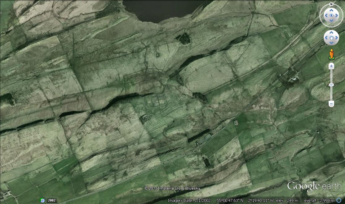
In effect  archaeology  is just a  posh Greek name for  what is  effectively  ‘dabbling around’ in history( a term once used to me in a lighthearted comment  to describe my work in finding a Roman villa).

Archaeology   can be all things to all men and usually is.

Perhaps I am being a little disingenuous, but how do you separate the metal detectorist(dirty word) who after all is just carrying out  geophysical surveying,   who finds some coins, records their location, informs the local county archaeologist who  then excavates the site and sends the finds off to numerous specialists for analysis. in comparison there is the archaeologist who brings in specialists to carry out geophysical survey, excavates the site,  then brings in numerous other specialists to tell him about the geology, the environmental samples, the pottery, the bone, the metalwork, the coins, the glass, the construction materials, illustrate the finds, etc, etc, etc.

The point I am really trying to make is that archaeology is the study of human history, and can be carried out by anybody with an interest in the subject, you don’t need a degree to be an archaeologist, it isn’t an end to end scientific specialism that needs structured  training, but a series of core basic skills and organisation, honed by practical experience, which is then   backed up by scientific specialisms coming  together under the broad brush umbrella of archaeology.

Archaeology  has two elements, the scientific analysis of the recovered data that provides us with the valuable bit of archaeology, namely   the chronology, application and use of material and artifacts, and the narrative story which in contrast can be anything the imagination can produce. Whilst the story of WW2 archaeology can be near enough completely built up using recorded facts, the further back you go the sketchier the facts become, until you get beyond the Roman period in Britain, when the recorded facts near enough  disappear completely , and the narrative becomes 90% pure conjecture.

Getting involved in archaeology  and ergo becoming an ‘archaeologist’  is just as achievable as a hobby, but of course to learn and do it well you have to become involved with like minded people with greater experience. First of all you need to establish what level of involvement you want.  There are  many types of  groups and societies available,  but many despite the publicity rarely offer practical fieldwork opportunities.  Just because a promotional leaflet indicates that that a group or society has carried out fieldwork in the past, doesn’t mean it is still doing it. If  practical archaeology is what you want to do, be certain to check they have a current fieldwork group working.

If you want to do serious research archaeology, focus on groups that carry out fieldwork on an ongoing basis, generally within their own resources.  Be careful  of groups that promote their ‘fieldwork’ on the assumption of  a heritage lottery grant funding application in process. These projects are usually  funding led rather than research led, and replacing  enthusiastic research led endeavour,  with paid labour just doing a job, and are usually geared  to maximise the archaeological experience for as many members of the community as possible. They rarely offer continuity of opportunity, and often are focused on safe known sites to guarantee results, not exactly the cutting edge of archaeology, but worthy work for those satisfied with limited horizons, and keen to develop their basic skills.

The following is how  I would group archaeological interest in the wider community.

Historian/Lecture Archaeologist

Usually principally interested in the historical  element of archaeology,  often without or at best limited interest in the practical application of fieldwork. These are the majority that usually make up the memberships of local archaeological  and historical societies,   happy with an annual lecture programme, occasional site visit, and  often attracted to the subject from experience of  personal  historical research in the area of their home community.

Social archaeologist

This group often join local societies with the same  general interest  in history as the above group,    but also  want to carry out practical archaeology as well.  Many are often surprised when they find the archaeological society they have chosen to join rarely if at all does  any fieldwork.  I call this group social archaeologists because in my experience their archaeology is but one element of their wider social lives, always badgering to do archaeology, but rarely committing their time to a project,  usually  making themselves available only for  the odd day that fits in with their personal schedule,   no matter how exciting the project  may be.

With the limited opportunities these days on research projects, it is increasingly difficult to fit this group into planned projects that require a structured volunteer workforce.  Opportunities in future for this group may be limited to lottery funded community archaeology projects, which are  funding rather than research led. Community archaeology is the current buzzword in archaeology, but in reality it is little more that a renaming of what once traditional fieldwork carried out by societies, universities and  local archaeology units etc.

If you only want the occasional day, then focus on projects geared to offering that type of opportunity, because there is nothing more annoying then  planning work for 10 people on a verbal committment, and then for only 5 to turn up.

Amateur archaeologists.

The two  above groups are all of course amateur archaeologists, however in reality the term really fits  those who  who are  willing to commit their time regularly to a project just like a professional, but unpaid.  Most research led groups will rapidly identify the people who are committed, and will offer them the opportunities as they arise. Social archaeologists may well only be  invited on the rare occasion that large numbers of volunteers are required.

Research archaeology is about serious commitment.!!


No 2: Investigative Archaeology

Investigative Archaeology!

An oxymoron or a contradiction!

Hmm!

INVESTIGATION

the act or process of examining a crime, problem,statement, etc,. carefully,especially to discover the truth.

To quote the creator of Sherlock Holmes;

” Once you eliminate the impossible, whatever remains, no matter how improbable, must be the truth.”

(Arthur Canon Doyle)

ARCHAEOLOGY

the study of human history and prehistory through the excavation of sites and the analysis of artefacts and other physical remains.

Archaeology is about analysing, which is to try and explain and understand what is in front of you.  Archaeology records factual data, then usually analyses that data against other analysed data,  developing   the existing  narrative by adding another   piece to the  5 pieces of the jigsaw already analysed.  The problem with this approach is  that the possibility arises that the jigsaw unknown to the analyst who  perhaps considers there are only  5 more missing pieces to be found,  actually has  500 pieces, and they only have the top right hand  corner of the jigsaw with blue sky and a seagull.   All the analysing in the world from this point on can only arrive at a  conclusion that the story is about sky and seagulls. Until somebody decides to look under the metaphorical sofa for any missing pieces of the jigsaw the analytical die is formed.

Investigating  in contrast starts at the beginning with a clean sheet without any assumptions or  narrative,  gathers evidence with a view to establishing  the facts,  or a further line of investigation.

For those reading this blog it  should be  apparent  that I subscribe to the view of investigating archaeology with a completely open mind.  I respect the views and interpretations of others, but they are their views, their interpretations and usually  the sum of  150 years of compound analysis, not necessarily anchored on a secure original footing.

By going back to the beginning and forming working theories based on  hard evidence, common sense and  logical thought,   rather than trying to fit in with the narrative of others, the investigations by the Mid Tees Research Project have achieved a modicum of success in locating a number of actual and probable  mainstream  military and civilian Roman sites   in the Tees Valley area in recent years

1 x Roman Villa

1 x Marching Camp

1  x Probable sub 100m x 100m Fort, Fortlet

4 x Possible sub 100m  x 100m Forts, Fortlets

1  x Probable small town ( Not ladder settlement)

I cannot emphasise enough If you are interested in  conducting original investigative archaeological research,  assume  nothing, be extremely cautious about embracing  established theories without question,   and I guarantee you will be  more productive in locating archaeological sites  wherevever you live. You will succeed because you will look in the areas already ruled out  of the historical narrative. If your research is sound,  your success is certain.


No 3: Geophysical Survey (Magnetometry)

With its important role in modern archaeology, this is the second in a series of brief tutorials into the mechanisms involved in geophysical survey.

Although coming from a radio engineering and electronics background, I am not going to bamboozle you with the boring science,  or big up the process as some sort of black art.

The most popular method of geophysical survey is the magnetometer survey, this is principally because it is  three times quicker to carry out than the next most popular resistivity.

A magnetometer is simply an instrument that can see magnetic fields, there are several different types, but for our introduction we will  just call them collectively magnetometers.

For a magnetometer to work we need a magnetic field. The earth is effectively  a giant lump of iron, with a magnetic field that runs through the planet and surrounds it.   We may think that apart from the  classic school experiment  of putting a magnet under a piece of paper  and sprinkling iron filings to see the magnetic field, our connection with magnetism is confined to those little magnets that keep the kitchen cupboard shut, or fridge magnets.  In reality the earths magnetic field is instrumental to  every part of our lives. Instead of giving them their collective name of the electro magnetic spectrum , i’ll  use terms such as electricity, light, radio, tv, mobile phones, x rays, microwaves, infra red, UV to name but a few. When the sun throws off solar flares, this interferes with the earths magnetic field and can shut down our power and communications networks, and return us temporarily to the stone age.

So magnetism is important, and it is an important tool for archaeology as well.  A magnetometer for use in archaeology  in its simpliest form is a vertical tube with two magnetic sensors.  The sensors are affected by magnetic materials in close proximity, hence the first rule of magnetometer surveying is to make sure you don’t have any metal that is magnetic on/in  your clothing before you start. If you have a replacement hip or shrapnel in your body, then amateur resistivity is probably a better choice. .  One sensor is mounted close to the bottom  of the tube to read the magnetic field that surrounds it, including the ground below it, the other sensor is mounted higher up the tube away from ground magnetic anomalies to record the background  magnetism and act as the reference.   During a survey both sensors take readings and the bottom sensor reading is referenced against the higher sensor as a + or – value.

Any given piece of land will have a background magnetic signature based on the geology, an ironstone outcrop underlying the site, will have a greater impact on a survey and sometimes make it impossible to get useful results, compared to  non magnetic  limestone for example.

What exactly is the magnetometer seeing ?

The minute somebody sticks a spade in the ground they are affecting the background magnetic field.  If you dig a ditch in clay, chalk or any other material,  then the ditch left to fill naturally will have a different fill to the natural. This fill could include the burnt residue from burning off stubble, it could include fire ash and charcoal from domestic or industrial processes, it could include the scale that flies off iron as it is being worked by a blacksmith, in fact anything that is burnt or fired ( pottery) will have a different magnetic signature than the natural. Unfortunately it can also include the shoes of  giant shire horses, lumps of tractor and other  detritus of modern agriculture. Ditches are the bread and butter of magnetometer surveys, if one is present it will likely to be picked up.

Of course it is not always that easy,  surveying the land of a former scrapyard over a henge monument is likely to be more useful in locating a buried  Austin Maxi than part of a  ritual  landscape.

The rest of the process is basic fieldwork. Layout a grid of a preferred size, subdivide each grid square into 1m strips, and traverse the strips taking a reading every meter along each strip, which in a 30m x 30 m grid square would result in 900 readings taken in the square.

Those 900 readings are entered into a piece of software which in the most simpliest of terms gives several colour or greyscale values for ranges from the  lowest readings through the background readings to the highest readings. These individual colours or greyscale values, when the 900 readings are laid out in the order they were taken will highlight anomalies. For instance if a red colour is given to the highest magnetic field  readings, we might get a red line if the feature is a ditch full of fire ash, If a yellow colour is given to the lowest magnetic readings, if   we might expect to get a yellow line.

Of course these things are subject to all sorts of caveats, geophysical survey can highlight archaeology in a given geology to an astonishing degree, in a different geology  with the same archaeology it can be as useful as a chocolate poker.

The apparent absence of archaeology in a geophysical  survey,  does not necessarily mean there is an absence of archaeology on the site. Geophysical survey should be used as part of a fieldwork investigation, it should  not be the only fieldwork investigation, and where it is at all practicable, it should be used in conjunction with other geophysical techniques.

in a nutshell you should if possible carry out both resistivity and magnetometry. Resistivity is good for identifying walls and structures, Magnetometry is good for identifying ditches and pits, bring both results together, superimpose them  on the aerial photographic evidence, and you should have a fair representation of what is below the ground.

Note ‘should have’, no guarantees in this game.

Here endeth the second  lesson.

No 4: Geophysical Survey (Resistivity)

With its important role in modern archaeology, this is the first in a series of brief tutorials into the mechanisms involved in geophysical survey.

Although coming from a radio engineering and electronics background, I am not going to bamboozle you with the boring science,  or big up the process as some sort of black art.

The two main types of geophysical survey use basic electronic principles to measure data.  The simpliest device is the resistivity meter which in reality is nothing more than a posh electrical tester that you might use to test a fuse,  or to check a battery and can be bought for about a fiver from Maplins or Ebay.  The process of resisitivity or resistance testing is based on the ability of a material to allow an  electrical current to pass through it(conduct).  Some  materials  are very conductive such as copper, hence most electrical cables are made of copper, some materials are non conductive such as rubber or plastic, hence the reason electrical cable is covered in rubber or plastic to stop you getting a shock.  To test conductivity we simply place two probes from a meter across the material, send a low electrical current through it, and its electrical   resistance value will be shown on the meter.

In archaeology   soil and clay all conduct electrical current, especially if wet. On a site without any known archaeology and  with a undisturbed geology,  placing your probes in the ground  at a constant distance from each other across the area should give  a general background level of conductivity.

Introduce archaeology into the equation and we return to what is conductive and what is not.  A ditch is a good conductor because it is likely to be wetter than the surrounding  natural, and therefore will give us a low resistance reading. A wall made up of stone or brick is likely to be drier than the surrounding natural, and will therefore be a poor conductor of electricity. and give us a high resistance reading. If however we have had heavy rain, the ground is likely to be saturated  even in and around a wall,  minimising the recordable difference that the instrument can detect.  Resistivity for best effect should be carried out after a period of dry weather, where buried  ditches are likely to be the only areas of dampness in the soil matrix, and buried stone walls and any fill in amongst the stones would  be drier than the natural. What is the optimum moment to carry out a survey, well that’s the $64,000 question.

The rest of the process is basic fieldwork. Layout a grid of a preferred size, subdivide each grid square into 1m strips, and traverse the strips taking a reading every meter along each strip, which in a 30m x 30 m grid square would result in 900 readings taken in the square.

Those 900 readings are entered into a piece of software which in the most simpliest of terms gives several colour or greyscale values for ranges from the  lowest readings through the background readings to the highest readings. These individual colours or greyscale values when the 900 readings are laid out in order they were takenwill highlight anomalies. For instance if a red colour is given to the highest resistance readings, if there is a wall present we might expect to get a red line. If a yellow colour is given to the lowest resistance readings, if there is a ditch present we might expect to get a yellow line.

Of course these things are subject to all sorts of caveats, geophysical survey can highlight archaeology in a given geology to an astonishing degree, in a different geology  with the same archaeology it can be as useful as a chocolate poker.

The apparent absence of archaeology in a geophysical  survey,  does not necessarily mean there is an absence of archaeology on the site. Geophysical survey should be used as part of a fieldwork investigation, it should  not be the only fieldwork investigation, and where it is at all practicable, it should be used in conjunction with other geophysical techniques.

Here endeth the first lesson.

No 5: LIDAR

This is the latest  in the Archaeology Made Easy series


LIDAR or Light Detection and Ranging is simply a posh name for an upscaled version of the laser measuring device you can buy from B&Q to carry out DIY

In its simpliest form  it is a laser fitted to an aircraft flying parallel with the ground that emits thousands of laser signals  which bounce off the ground surface as the aircraft flies over, and are reflected back to a receiver on the aircraft, which are then put together using software into a mosaic giving absolute heights to the ground surface.

The unique value to archaeology is that LIDAR can reveal extremely low lying earthworks, and even a ploughed out ditch that may be invisible on the ground, but is still actually slightly lower than the surrounding land. From an archaeological perspective perhaps the most useful effect of LIDAR is the ability to effectively  see below undergrowth and tree cover to the woodland or heath ground surface beneath.  From a non-archaeological perspective it is widely used for land management, especially flood plain and watershed management and planning, drainage issues for development,  and geology generally.

Until recently LIDAR was a commercial product, and unavailable to non funded research and amateur groups. However recently the Department of Environment has generously made their LIDAR library of 0.5m, 1m, and 2m available for open source use.  The file structures available for LIDAR include Digital Elevation Models (DEM), Digital Surface Models (DSM), Digital Terrain Models (DTM), with the latter two being available on the Dept of Environment site. For archaeology DTM is the better option as it creates a 3D effect after processing,  and effectively strips off the tree cover, which makes the archaeology easier to interpret.


The following is the procedure to follow:

To process the LIDAR, you will need some sort of GIS mapping software to download the raw data. I use the open source QGIS which I find is excellent, it is a free full feature mapping package. If you haven’t got a GIS you can get QGIS here:  http://www.qgis.org/en/site/

Once you have a GIS package you can download and process the LIDAR data. The following is not intended to make you an expert in Graphical Information Systems(GIS), but simply to allow you to open LIDAR to a useful standard. There are plenty of YouTube tutorials on using GIS generally including some for archaeology specifically.

1.    Go to  the Environmental Agency:
http://environment.data.gov.uk/ds/survey#/download
Zoom into the map,  and download the relevant DTM file containing the grid block you want, at whatever resolution,  Once downloaded unzip the folder and file it somewhere. Please note, each ZIP file will contain multiple LIDAR tiles, identified by a 4 digit grid reference such as NZ3510,  when zooming into the Environmental Agency map, make a note of the 4 digit reference of the grid you are interested in to make it easier to find later in the file.
2.    Open your GIS platform, Click on LAYER> ADD Layer> ADD RASTER LAYER, which will bring your document files  up. Go to the file you saved your DTM files in, click on the one you want,  and a blurry image should appear in the QGIS  box.
3.    Click on RASTER>TERRAIN> HILLSHADE, and the HIllshade dialogue box should appear. Click on the OUTPUT LAYER and pick a file to bung the processed image in. ( Make sure you put in the full file address, the best way is to do this, is to go to the file itself and click it from there, which will put the full file address into  the Output Layer dialogue box for you. . If you only type the basic file name in the Output Layer such as BlackWood or some such name, it will not be able to process and file the data, so full file name including c:/ etc, etc, etc.), the only other thing you need to check is to  make sure GeoTIFF is the output format.

You can alter the  3D effect by adjusting  the illumination angle in the Hillshade dialogue box,  what you are effectively doing is positioning a faux sun to shine across the image. Effectively you can add illumination around 300 degrees  of the compass, and with an angle as high as 40 degrees above the horizontal plane, which effectively allows a faux winter sun  with long shadows in the low degrees up to a higher spring/ summer sun with short shadows up  towards the 40 degrees. Leave it at the default setting initially  and see how it looks, you can then open up Hillshade again, and play about with the angles if you need to, until you get the most effective image. Press OK and the image should render and file to the values introduced.

This is the basic technique, it produces the grey scale image as demonstrated below, to achieve the colour image to accentuate which are the lower and higher features, requires further processing, which is a technique for those who wish to develop their expertise in using GIS and LIDAR further, but outside the scope of this basic tutorial.

The image can then   be moved to photo editing software like Adobe Photoshop, which allows the image to be manipulated  with  filters and false colours.

Here are a couple of examples of what can be achieved courtesy of Steve Kaye at Banda Arc Geophysics.

wOODHOUSE fARM
Google Earth
LIDAR
LIDAR

No 6: Air Photography

What is there to say about air photography in archaeology?

It seems simple get an aircraft,  get a camera, fly around, take photographs of funny squiggles, lines,  lumps and bumps on the ground below you,  land , send the film off to be developed,  and on its return try and remember where the photos were taken, and what it was you thought you had photographed.

Or at least that is what  it used to be like.

Air photography can be broken down into two elements, high level vertical air photography where an aircraft flies straight and level across a landscape photographing at  right angles to the ground, and oblique air photography, where a smaller aircraft at low level usually circles a feature wing down, whilst the cameraman takes images, the angle of the aircraft to the ground is therefore not constant, creating a distorted perspective.  Vertical aerial  photographs can generally be superimposed straight onto a map for reference, oblique aerial photographs need to be rectified to be useful, requiring the location of several points of reference on the image to lock it into a map. Both techniques are used extensively in archaeology, but whilst oblique photos taken exclusively for archaeology are usually  taken when the conditions are at the optimum to highlight the archaeology.  Vertical aerial photographs are nearly always taken for commercial purposes and only by sheer luck might they be taken at the most opportune time to capture archaeology.

Air photography to be useful for archaeology usually  has  to be taken on growing crops in their ripening phase in early summer, on earthworks and standing monuments, when the sun is lower in the sky creating shadows,  or in the winter when a light covering of windblown snow can accentuate standing features,  or in the late phase of a deep snow melt, when the north face of an earthwork delays the sun completing the melt.

Air photography for archival purposes was carried out pre 1939, and there is some very good footage of the immediate post 1918 landscape of the western front in all its gory detail.  However  air photography as a mapping and analytical tool especially for archaelogical research really came into its own immediately after WW2.

https://www.youtube.com/watch?v=SdFwEfoIM3E

With a surfeit of aircraft and pilots with little to do,  the RAF carried out several   aerial  photograph  mapping series of the UK after WW2 with the most commonly available series  being those taken in  1946 and 1948 , a local collection of these series can often be found in archives and the major reference libraries across the UK, although they are often not indexed.   Aircraft would fly horizontally at a given height backwards and forwards across the country taking thousands of photographs that slightly overlapped each other. The idea of the overlapping was  that with the use of a  a simple stereoscope two adjacent images could be adjusted to give a binocular 3D image of the landscape.

Neasham. 540 Sqn. 21st Aug 1946
Neasham.
540 Sqn. 21st Aug 1946

Low level oblique air photography for archaeology was initially carried out by enthusiastic amateurs with pilots licences or access to  small aircraft. Later on  archaeologists were funded by bodies such as English Heritage to take images at different times throughout the year,  revealing  different features under different conditions,   AP’s from these sources form the bulk of the national AP archive, The one caveat about all these photos, is that some sites on some geologies do not present well for AP’s, and so the record is  seriously incomplete and  prone to giving undue prominence to a particular type of site in the absence of other contempary sites, potentially distorting the overall picture.  it is also necessary  to raise question marks  regarding the interpretation of some of these sites.  Archaeology to avoid putting ‘we don’t know what it is’ against the AP and highlighting it with a big red flag for others to easily find and consider has  developed a series of generic catch all terms to fit any eventuality such as prehistoric/medieval field system, sub-rectangular enclosure to name but two, ensuring that any non standard site will be subsumed into the clutter of thousands of AP’s,  probably never to be found again. This was the principle reason the Mid Tees Research Project came into existence.

Oblique AP of marching camp field with double ditched feature. Photo taken by Blaise Vyneer, reproduced by courtesy of Tees Archaeology
Oblique AP of marching camp field with double ditched feature.
Photo taken by Blaise Vyneer, reproduced by courtesy of Tees Archaeology

Finally we have a free,  map quality resource, flexible, eminently adaptable and easily accessible to every house with a computer or tablet, namely Google Earth. Not only have we Google Earth but we have their 2006 series which was taken at the optimum time for crop marks, with archaeology popping out everywhere.

So how do we look for crop marks with Google Earth.

 In a straw poll I carried out I found that for general viewing most people zoom into Google Earth to a height of about 2- 3km.(Google Earth shows the height from the ground of the zoomed image in the bottom right hand corner of the screen). This height  maintains the points of reference of towns and villages to give the viewer situational awareness., however at this height the chances of seeing archaeology are minimal. The following AP is a screen shot of Housesteads and Hadrians Wall from 3km, despite all the standing archaeology in the shot, it is not exactly jumping out at you.

Housesteads and Hadrians Wall from 3km

To find archaeology you have to get down and dirty with the landscape and zoom into about 600m or less which is effectively the height a light aircraft would be taking oblique images, this means you are effectivaly looking at one field at a time. The following images example the problem, both are  sites in the Tees Valley taken from the 2006 Google Earth series and  both on boulder clay. The ditches of the Thorpe Thewles Iron Age enclosure and round house, are clearly visible from both 300m and 600m. The Roman villa at Dalton on Tees with buildings with 1 metre wide walls are barely visible at 300m, and not visible at all at 600m.

Dalton on Tees and Thorpe Thewles at 300m and 600m
Dalton on Tees and Thorpe Thewles at 300m and 600,

AP’s of course are only part of the picture( excuse the pun), and should be the starting point for other field survey techniques.

No 7: Time Lapse Video

A pleasant Easter weekend arrived with me ‘volunteering’ to help Steve Sherlock excavate a round house constructed in 2005, which burnt down 3 days later at Kirkleatham Hall, Redcar.

With the passing of 12 years it was an idea that excavating the modern destruction of the roundhouse,  with the full knowledge of its original construction techniques may offer some element of comparative analysis in the destruction  of excavated real round houses.

My role,  as well as getting roped in to scrape muck was to provide a overhead timelapse video record of the excavation  over the four days, that would be edited to give us a 10  to 15  min time lapse video of the whole excavation.

To film this event, I used a standard 7m telescopic alluminium mast used by radio amateurs which was guyed at the top, a cheap and cheerful bit of kit,  this system was used at the Newsham excavations in 2015, and despite heavy winds on most days provided a stable platform for filming.

I used a Go Pro Hero 5 to film the event with a large memory card to allow hours of filming.  These cameras are outstanding bits of kit, with image resolution upto 4k,  providing  imagery that is the same if not better than most DSLR cameras. They are  waterproof. and can be used under water if it takes your fancy. They are  effectively the hi-spec image capturing device and circuitry of a top spec DSLR, without all the lens, heavy case and ancillary functionality needed for normal camera work. The GoPro has both Wi-Fi and Bluetooth functionality, and all functions can be controlled remotely by a phone or tablet whilst in operation on the top of the mast.

The camera was attached to the mast  using one of the array of clamps from a clamp kit available on ebay for a modest price.

The only addition to the standard kit that was required was jury rigging some sort of external power for the camera. The battery in the camera  will probably run for 1.5 to 2 hrs before requiring recharging. The impracticalities of dropping the mast several times a day, losing the framing, and the best part of 30 mins filming each time was impractical.  I therefore used a cheap 12v to 5v USB converter off EBay to do the job, added  a length of 5 amp 2 core lighting flex to the length of your mast, and at the bottom,  connected it to a LIthium Polymer (LiPo) 3s 10.8 v  battery used by drones, and which are readily available on Ebay.  The 10.8v voltage is dropped by the USB converter  to the 5v which the Go Pro needs, one charged LiPo ran the GoPro for the whole 4 day excavation without recharge.

Video normally runs at 30 frames a second. To get the time lapse effect of speeded up motion, we take images at less than 30 frames a second  and then play them back at 30 frames a second (This is all done by the GoPro, so nothing complicated.

The rule of thumb for time lapse is if there is visible movement in your scene then set the timelapse to between 1-3 frames per second, this will allow somebody to walk across a scene, with the viewer  seeing the full movement of their gait, higher frames per second will see them effectively jump from one place to another. Non perceptible movement such as the sky at night or  a flower opening will require much longer frames per second times.

For the purposes of this excavation we used 1 frame per second, which effectively reduced the recording time to 1/30th of the 6 hrs per day we were excavating, which when  run at 30 frames a second takes 12 minutes to view. With the removal of lunch breaks , tea breaks etc, we are hoping to condense the whole 24hrs of excavation into a watchable 10 to 15mins.

This is hot off the press, I will add some of the time lapsed video, and links to the kit we used later.