Category Archives: Uncategorised

Council for Independent Archaeology Annual Conference

The Council for  Independent Archaeology has  been central to the debate on archaeology for many years, defending and promoting a vision in the best traditions of amateur archaeology.

The annual conference of the CIA will take place this year at the Sharpes Pottery Museum, Swadlincote, South Derbyshire  on the 20th October 2017, where an interesting series of talks have been arranged. The conference fee is £20 which includes a buffet lunch together with tea, coffee and biscuits throughout the day. The AGM for members starts at 9.30am with the Conference proper starting at 10.25am.  The Conference is open to all interested archaeologists, independent, amateur, professional or student.

http://www.sharpespotterymuseum.org.uk/

The provisional list of talks is as follows, with others to follow.

  1.  Monks, murder and myths: An archaeological journey through Mercia from Repton to Peakirk         Dr Avril Lumley Prior

2. Industrial archaeology of Sharpes Museum and the Potteries of            South Derbyshire   –    Philip Heath

3. Troy House, Monmouth:  Archaeological aspects and fascinating           history of Troy House, the 17th Century Mansion near Mitchel            Troy   –    Dr Ann Benson FSA

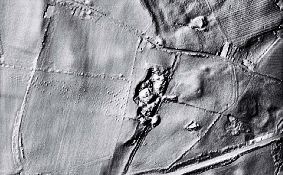
4.  Aerial Photography of Roman Roads in South Wales  –   John                     Sorrell

5.  New views of LIDAR for Wallingford Castle and Town –  Kevin                 Barton and Gerard Latham

6. Littleover Boundary History Project using non-invasive                               archaeology     Tony  Brookes

7. The MkII TR/CIA resistivity meter and plans for the future                        Bob Randall

Of particular interest to those conducting field projects should be the excellent equipment being produced under the TR/CIA banner. The Mk1 resistivity meter has been in use now for many years, and the MkII is a generational leap in the technology, transmitting the data  into a tablet providing instant plots of the survey as it is being conducted. This meter is half the price of comparable meters. Bob Randall will be talking about the direction this exciting project will be going in the future.

For those interested in attending, in the first instance please contact for further details and a booking form.

Keith Foster

Hon Treasurer

2 The Watermeadows

Swarkstone, Derby, DE73  7FX

Tel: 01332 704148

e-mail: skfoster@btinternet.com

And that was 2016!!

Happy New Year for 2017, but where did 2016 go?

When I posted my salutation a year ago with the optimism of another year of archaeology ahead, it never crossed my  mind that plans both short and long term can be upscuttled in a moment.

For me 2016 was a strange year, in a sense the events made it a perfect year for removing archaeology from its cosy  compartmentalisation of life, to understanding it for what it really is, nothing more than millions of individual lives and experiences, all equally unique, all equally important, and all equally beginning and ending at the same place.

2016 was eventful for me personally   for the passing of friends and relatives, the  pleasure of a son’s wedding, the sheer hard graft of helping to turn a nondescript house into a home for my son and his new wife, and finally the excitement just after the New Year  of a grandson’s arrival a month early.

So archaeology has had to take a back seat for a while, that’s okay, it isn’t going anywhere.

Christmas Archaeological Conundrum.


Christmas Conundrum

Merry Christmas.

It’s that time of the year again, food, food,  food, too much booze, and the yearly repetitive cycle of regurgitated TV from all the broadcasters boring you to distraction.

So here you go, a challenge to you all!!

The image  is a LIDAR image of a piece of landscape  with archaeological features.

The features of potential archaeological interest on the image are unknown to archaeology,   spanking brand new finds.

 Archaeology of course has a habit of finding two stones and calling it a wall,  3 stones and calling it an alignment, making the evidence fit the established narrative is the bread and butter of archaeology. Can you can see something you think you can identify on the image, do  the characteristics  fit  into any particular time period, what might its likely purpose be if found in a given location etc, etc, etc.

The presented image is not a photograph, but a LIDAR image. For those not familiar with LIDAR, it is an aerial technique where an aircraft flies over the landscape emitting a laser beam toward the earth, which bounces of the earth and is received back at the aircraft, the time delay for the return signal provides the data to calculate the elevation of the land surface at that point. The technique is used extensively to  locate pinch points in watersheds which may cause flooding, and other environmental and agricultural analysis.

For archaeology it is particularly useful for its ability to record very low earthworks that are not visible in aerial photography, and for penetrating vegetation cover to see the profile of the ground surface underneath. There are a number of different LIDAR techniques, the one used on the image is Digital Terrain Mapping which has the effect of flattening  features. For archaeological purposes to get the best out of the image it needs to be further processed using an image editing software applying filters to give the image a  3D effect.

The image covers an area 750m x 450m, the black splodge in the middle is a worked out quarry, the highest point is  is 196m OD, and it is north of York and south of Newcastle. and  that is your lot.

There is no prize for getting it spot on,  apart from the cache of knowing  that when it comes to locating this type or archaeology, you know your onions.

Don’t be shy have a pop at it, either on the blog comments or mail me at:

john.brown@reiverenglish.com

When is a Hole not a Hole? When it is a Post-Hole apparently.

I want you all to be honest with yourselves!

Can you hand on heart say that you have  ever read cover to cover all those archaeological reports that you have accumulated on your bookshelves over the years, all those shiny volumes bought enthusiastically at your local society events, dayschool’s and conferences.  Are they essential bedtime reading, or simply gathering dust between  the Book on National Trust Houses and the RSPB Book on British birds.

I am probably being a slightly  unfair.  Of course you have probably looked at the colour pictures of the key finds,  probably read the introduction to the site, and even perhaps the conclusions, but have you really read the chapter that has 50 drawings of assorted shaped post-holes, have you really read the wordy analysis of those three cruddy pottery finds, or the section on that xrayed lump of corrosion deposit that once might have been a nail . I hope not, or I fear for your sanity.

An archaeological report published at great expense in both money and time for a production run of 250 or so, is perhaps the most pointless use of resources imaginable. Months and months of work, numerous peer reviews, some specialist reports that are nothing more than an exercise in printed verbiage,  all simply to produce a monumental tome to sit aside the equally unread monumental tomes that are so full of if’s but’s and maybe’s that any conclusions they may have arrived at, are out of date practically before the ink is dry.

Nothing more than a massive exercise of ego and profligacy  over common sense, especially when the core information could be put into the public domain at a fraction of the cost.

It is at this point  that I arrive at the title of this essay…   POST-HOLES

Post-holes are the bread and butter of archaeology, to the active imagination they create circles, alignments, ritual activity, all on the basis of a hole  in the ground.  If you look at  any report  hours and hours of work is put into drawing them  in minute detail, as if millimetre recording will somehow  explain their purpose, when the only thing all the hours of work reveals  is that it is still just a hole in the ground.

Draw it on a plan , record its width and depth, make a note of any packing stone,  take a picture and analyse the deposits if you have the money  within it, but why on earth do we need  a sectional drawing of a hole probably dug without any particular care, just like holes have been dug in the ground  for ever  by a man with a shovel.

The reality is post-holes as evidence of a structure are  5% evidence and 95% guesswork.  I could plant 4 x 300mm posts to form an 8m square, and build a modern detached house on it, which on   having disappeared in a thousand years time would be simply four post- holes in the ground  for future archaeologists to wax lyrically  over..

The fact  is archaeology in the modern world of technology and instant imagery is still clinging to the techniques of the 19th century antiquarians. We live in an information age, it is time we abandoned the cleft stick in the form of large and incredibly expensive publications full of outdated recording techniques that nobody reads, and begin thinning them out to a more readable form, and we could start with leaving out the reams of post-hole drawings, stick to the facts,  and  dump the generally speculative pie in the sky analysis of their purpose.

Quid Pro Quo….

Amateur archaeological endeavour  in the post 1990 PPG16 world has to some degree been conditioned by developer funded archaeology  into the mindset that useful amateur archaeology can only be undertaken either as a subset of a funded project, or by establishing an independent funding stream before a trowel is dusted off.  With archaeology now subject to the same austerity as everybody else, we have to relearn the art of making do and mending.

Having spent many years acquiring the techniques of geophysical survey, I had developed a certain level of expertise, especially in the use of open source software to carry out analysis of survey data.

A couple of years ago I was approached by a community archaeological project at Hinderwell, nr Whitby. They had acquired a magnetometer and  resistivity meter through grant funding, but despite paying substantial sums for training, had been unable to get consistent and ongoing support  in the techniques of geophysical survey. Now with their funding ending, they were between a rock and a hard place,  instruments worth £20,000, and a lack of expertise in how to use them,  or process the data.

After an initial paid series of workshops, getting them upto speed on survey techniques, and introducing them to Snuffler the open source software, I came to an informal arrangement to offer my ongoing services for free, in return they would allow me the use of their instruments to carry out work on my own site.

The Mid Tees Research Project is a direct result of the generosity of Anthea Ellis and the management team at the Jet Coast Development Trust,  in agreeing me extended use of their equipment, whilst in return I would ensure that their fieldwork group is fully supported in carrying out their own  geophysical research and analysis.

A classic example of quid pro quo, and in my opinion, the only way forward for research archaeology, namely the sharing of scarce resources, whether human or technical.

Happy New Year!!

Welcome to the Mid Tees Research Project website.

Thank you for your patience.

If you have been watching the site over the last year, it has been a long time coming, but we are now at the beginning of the process of populating the website and ironing out the glitches. We have been playing about with the format attempting to come up with a simple and easily accessible style without all the bells and whistles, while remaining informative. We think we have made it as simple and easy to use as possible, but please let us know if there are any annoying elements.

The site can be broken down into basically three sections.

1. The Blog

This is the front page and will be the window into what is going on within the project,  with regular comments and updates about work within the site and information on fieldwork opportunities as they arise, together with news on the work of other amateurs (and professionals)  working in the wider region.

2. Open Archive.

This will be publishing portal for any projects working within the MTRP.  It will also hopefully become the portal for online publication of material from historical  research  carried  in the  Mid Tees Valley that may or may not have been published in hard copy.  In order to disseminate data to the widest possible audience for consideration, we consider it more important that data is made available for research,  even in its raw form,  rather than it remaining  hidden from view for the sake of a controversial crossed ‘T’ or a questionable ‘I’ dotted.

We are not precious about our project, we welcome useful information from wherever it comes, and are happy to give it a platform.  Material will be identified as being published, unpublished though subjected to peer review, or raw research and fieldwork data. If you have done research, found anything interesting, drop me an email and lets’s spread the knowledge.

3. Research Archive.

This archive will be password protected, and be available to  project teams  working independently within the site to co-ordinate their activities.  It will be the repository of a Site Diary, Aerial Photography imagery, mapping and GIS material, LIDAR images, geophysical survey plots and data,  and the rolling results of work in progress.  Temporary access may be given to bona fide researchers from outside the project who establish their credentials.

That’s the basic outline of the site, it may change as we move forward, but hopefully not too much,  please be patient as we  I will try and keep you amused or annoyed with my witterings on the blog.