Seeds of Goosepool

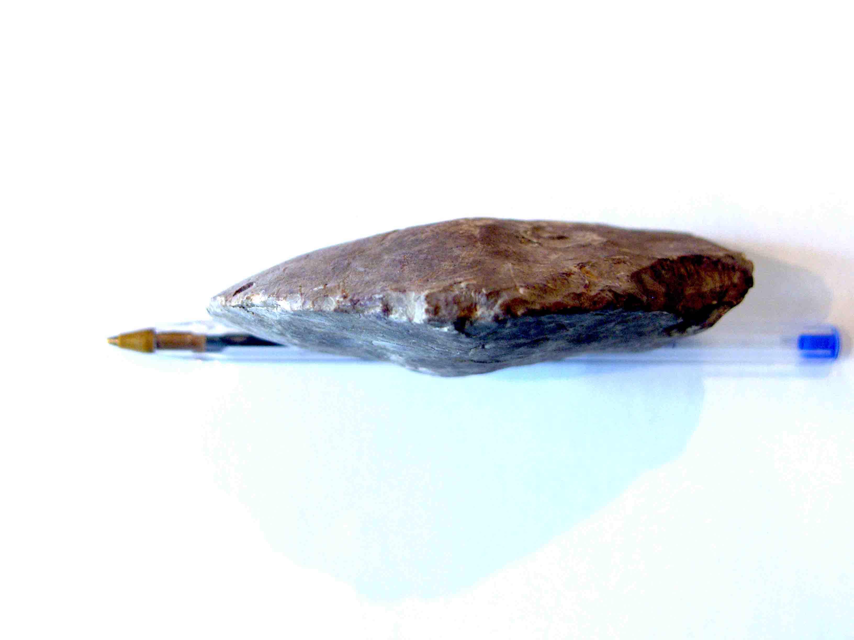
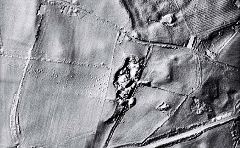
One of the things I would like to see on the site  in addition to our  own archaeological research,  is a viewing window for research and projects carried out by others of any period in our area of interest.

Lancaster bomber 2lancaster-bomber

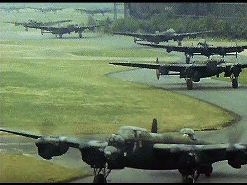
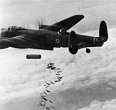
I bumped into an interesting DVD recently called Seeds of Goosepool, this is a narrative about the history of what we now know as Durham Tees Valley Airport, which in  a former life was a front line Royal Air Force bomber station called  RAF Middleton St George.

The DVD is one of  a series on regiments and units produced by Paul Frost  and his media company.  Many thanks to Paul for allowing MTRP to use the material free of licence.

http://www.paulfrostmedia.co.uk/about/

Bomber Command lost more than 55000 airmen during the war, the highest loss rate of any of our armed forces. In the flights from the airfield – known locally as Goosepool – on average five aircraft and 35 men would be lost every night. Now their lives are being honoured in a poignant and dramatic documentary which tells their heroic story.

A DVD entitled The Seeds of Goosepool is the product of a year-long labour of love by former Gazette reporter and TV presenter Paul Frost who produced and directed the film.

It was officially launched at a pub near the airport. The date and place of the launch are significant: the Royal Oak was a favourite watering hole of the airmen, and it took place on the 70th anniversary of Goosepool and the 40th of the airport.

One of the Canadian fliers, Andy Mynarski, won the Victoria Cross. The DVD features his story, as yet unpublished.

There is also the story of one heroic flier – McMullen – who stayed at the controls while his stricken plane was coming down over Darlington. He hung on until his crew had all bailed out, to avoid ploughing into the town and possibly killing hundreds of people. He lost his life crash landing in a field. He is remembered today by McMullen Road in the town.

Also on the film are Second World War photographs, rare footage, first-hand accounts of the almost suicidal raids and what’s left of the base on the south side of the airport.

The title was inspired by rare alpine plants which still flourish around the former Lancaster bomber turning circles.  Paul said: “The seeds were lifted into the night sky in the bombing firestorms, stuck to the aircraft and were flown back to base where they took root. “They’re found only at the former aerodrome – and at the targets in Germany.” The plants even attracted a visit from celebrity naturalist Dr David Bellamy.

The DVD’s Halloween launch was also significant: one of the Canadian units was named “Ghost Squadron” because of the number of losses. Paul said: “Those boys were thousands of miles from home, in the prime of their lives, in a strange country risking death or serious injury every night of the week. If they reached the age of 25 they were thought of as old men. They are part of Teesside history and we owe them a tremendous debt,”

The bombs were made at Aycliffe Munitions Factory by a work force which included Paul’s mum Doreen, 85.


Looking at a Roman site and up pops a Lower/Middle Paleolithic hand axe.

When I said archaeology had to take a back seat,  what I really meant was that archaeology had to take a back seat from being all consuming. The problem is the more you look, the more you find.

Mooching around one of my  postulated Roman enclosure/small fort sites,  which lies on alluvium and glacial sand and gravels, up pops this hand axe. No expert on prehistory but it seems to fit anywhere from the  Acheulian 0.5 million years ago, upto the Mousterian, as recently as 40,000 years ago.  I’ll leave to others to nail it down.

Interesting item, roughly 100mm (4″) x 75mm (3″), and has a edge worked from either side, which has created a rudimentary saw blade  effect. Fits beautifully in the hand even to the notch for the thumb to grip it.

if anybody is interested in further info or to have a look at the axe, drop me a line.

SAMSUNG DIGITAL CAMERA

SAMSUNG DIGITAL CAMERA

SAMSUNG DIGITAL CAMERA

And that was 2016!!

Happy New Year for 2017, but where did 2016 go?

When I posted my salutation a year ago with the optimism of another year of archaeology ahead, it never crossed my  mind that plans both short and long term can be upscuttled in a moment.

For me 2016 was a strange year, in a sense the events made it a perfect year for removing archaeology from its cosy  compartmentalisation of life, to understanding it for what it really is, nothing more than millions of individual lives and experiences, all equally unique, all equally important, and all equally beginning and ending at the same place.

2016 was eventful for me personally   for the passing of friends and relatives, the  pleasure of a son’s wedding, the sheer hard graft of helping to turn a nondescript house into a home for my son and his new wife, and finally the excitement just after the New Year  of a grandson’s arrival a month early.

So archaeology has had to take a back seat for a while, that’s okay, it isn’t going anywhere.

Christmas Archaeological Conundrum.


Christmas Conundrum

Merry Christmas.

It’s that time of the year again, food, food,  food, too much booze, and the yearly repetitive cycle of regurgitated TV from all the broadcasters boring you to distraction.

So here you go, a challenge to you all!!

The image  is a LIDAR image of a piece of landscape  with archaeological features.

The features of potential archaeological interest on the image are unknown to archaeology,   spanking brand new finds.

 Archaeology of course has a habit of finding two stones and calling it a wall,  3 stones and calling it an alignment, making the evidence fit the established narrative is the bread and butter of archaeology. Can you can see something you think you can identify on the image, do  the characteristics  fit  into any particular time period, what might its likely purpose be if found in a given location etc, etc, etc.

The presented image is not a photograph, but a LIDAR image. For those not familiar with LIDAR, it is an aerial technique where an aircraft flies over the landscape emitting a laser beam toward the earth, which bounces of the earth and is received back at the aircraft, the time delay for the return signal provides the data to calculate the elevation of the land surface at that point. The technique is used extensively to  locate pinch points in watersheds which may cause flooding, and other environmental and agricultural analysis.

For archaeology it is particularly useful for its ability to record very low earthworks that are not visible in aerial photography, and for penetrating vegetation cover to see the profile of the ground surface underneath. There are a number of different LIDAR techniques, the one used on the image is Digital Terrain Mapping which has the effect of flattening  features. For archaeological purposes to get the best out of the image it needs to be further processed using an image editing software applying filters to give the image a  3D effect.

The image covers an area 750m x 450m, the black splodge in the middle is a worked out quarry, the highest point is  is 196m OD, and it is north of York and south of Newcastle. and  that is your lot.

There is no prize for getting it spot on,  apart from the cache of knowing  that when it comes to locating this type or archaeology, you know your onions.

Don’t be shy have a pop at it, either on the blog comments or mail me at:

john.brown@reiverenglish.com

The Rise and Fall of the Late Iron Age Royal Centre at Stanwick ( Elgee Memorial Lecture)

On Saturday the 5th December 2015, the Teesside Archaeological Society hosts the annual Elgee Memorial lecture at the Dorman Museum, Middlesbrough  between 1000 and 1200. A registration link is available at the bottom of this post.

“The Rise and Fall of the Late Iron Age Royal Centre at Stanwick, North Yorkshire with Professor Colin Haselgrove (University of Leicester).

The enormous earthwork complex at Stanwick, west of Darlington—enclosing nearly three square kilometres—is the largest continuous prehistoric fortification in Britain, comparable to some of the most important late Age settlements in continental Europe.

In this lecture Professor Haselgrove will present new interpretations based upon excavations by Durham University in the 1980’s and research that has taken place over the past 25 years. Radiocarbon dating shows that Stanwick was occupied from the early 1st century BC. The early settlement differed little from others in the Tees valley, but soon after 50 BC, the site was reorganised and fortified, and successive monumental timber structures were built. Imports from other parts of Britain and the continent imply that well before the Roman invasion, Stanwick had attained a similar level of importance to known royal centres elsewhere in Britain and Ireland.

Soon after in AD 43, Cartimandua, the ruler of the Brigantes, entered into a treaty with the invaders. Many unusual Roman goods dating to this period recovered in the excavations must have been gifts showered on the queen, whose residence Stanwick surely was, and the massive perimeter earthwork was constructed in a display of her prestige. However, her rule over the Brigantes did not last. In AD 69, after a rebellion led by Venutius, her estranged consort, Cartimandua sought the protection of the Romans. They quickly set about the permanent conquest of the region—and Stanwick was abandoned.

As well as illuminating the social and political dynamics of the period, the research has cast new light on the everyday lives of the Iron Age inhabitants of the Tees Valley and their ritual and mortuary practices, some of which were continued by the agricultural population of the area in the Roman period. ”

When
Where
Dorman Museum – Linthorpe Road  Middlesbrough,”
Registration

Bookshop

Now and Then Cleveland Ironstone Mines David Currie and Stephen Sherlock
Now and Then
Cleveland Ironstone Mines
David Currie and Stephen Sherlock

Considerable numbers of self funded publications in local history and archaeology are published every year, yet  rarely see the light of day outside of the community that produced them.

Many of these publications  are of great interest, sell out and recoup their costs,  but many others  don’t, and end up  in a cardboard box in somebodies wardrobe.

This work deserves a wider circulation, hence our decision to offer this service. We will be happy to advertise any remainder copies on our site for sale , or any  used out of print  publications in good condition.

The price and postage cost is to be determined by the vendor, and the despatch  of the product to the customer is also the responsiblity of the vendor.  Our role is simply to act as a   window for the publication to be offered for sale , and complete the purchase using our Paypal account.  The only charge will be on the sale of an item  for which we will make a charge of 15% of the purchase price, all proceeds  will be used to support our work on the Mid Tees Research Project.

The first publication we will be offering shortly is pictured above. Published in 1996 the book on Cleveland Ironstone Mines is  74 pages long, the remainder copies have been languishing in my  wardrobe for years.

Please contact me if you have any books you want to offer for sale.

 john.brown@reiverenglish.com

John Brown

IMG_2569

I was first attracted to archaeology in the late 1980’s with my brother Graham,   but for the life of me I can’t remember what attracted me to the subject in the first place. I probably followed the same route as many.  An interest in history, initially a number of evening classes led by Cleveland County Archaeology Unit, before completing  a Diploma in British Archaeology at the University of Leeds in the early 90’s.

I joined the Teesside Archaeological Society and volunteered to set up a  fieldwork group, whereas  I was enthusiastically co-erced onto the committee,  shortly afterwards to be ‘promoted’ to serve also  as secretary for a number of years.

I established the Mid Tees Project to look at the neglected Roman period in the Tees valley, especially the significance and role of Cades road, and carried out a number of investigations, including investigating and establishing  the Roman villa at Dalton on Tees as a classic developed villa, moving the extent of the villa landscape north to the Tees.

Ding dong bell, Brownie's down a Roman well.
Ding dong bell, Brownie’s down a Roman well.

In 1999 I gave an impromptu talk on one of my pet areas of interest geophysics,  to the Council for Independent Archaeology at their Sheffield congress on ‘Demystifying Archaeology’, after all three speakers pulled out. It is refreshing to see that the CIA from those early tentitive steps now produce the budget TR/CIA resistivity meter which  has 100 units carrying out valuable amateur archaeology.

In the real economy I am a communications and electronics specialist, and have a particular interest in the use of technology in archaeology, especially in the geophysical survey area, My  working life however has  switched between running my own business locally,  and employment maintaining national communication infrastructures, this coupled with the needs of a growing family resulted in limited opportunities to conduct research. After 1999 there was   an 11 year gap in my archaeology due to work and other pressures,  before returning to archaeology in 2010. In the intervening years the Mid Tees Project went into a long slumber, as the principal (me) left the scene. On returning to archaeology and waking up the project,  I have made it incumbent  that in future there  should be no single principal , but a co-operative  project to ensure project continuation. My first port of call for leaders for the project were Jenny Parker and Linda Davies from the early days.

I have from the beginning always considered myself an  amateur archaeologist, who spurns conventional thinking and established theories,  in preference for  original research and fieldwork. A key focus of my work has always been the promotion and extension of traditional amateur archaeology , which since the early 1990’s has been  under threat.

Although the instigator of the project, I principally manage the  landscape research and geophysical investigations of our survey area, whilst also maintaining and writing this blog, and occasionally sticking a shovel in the ground when the urge takes me.

The Great North Road

A major part of our project is understanding the significance of Cades Road(Margary 80a), the eastern  twin of Dere Street running north/south through the Vale of York.

Often in  focusing on a defined historical period for research, it is easy to become out of sync with that which went before and after.  Most will  have heard the urban myth of the A1 being on top of  Dere Street on its route through North Yorkshire and Durham, but is that actually true.

The Roman road Dere street is  a Roman military road hugging  the eastern side of the Pennines through our research area,  transecting  the entrances to the upper Yorkshire and Durham Dales.

After leaving Catterick on the Swale and passing Scotch Corner the  start of  the east/west route across the Pennines,  Dere St leaves the alignment of the  modern A1, and slowly begins  its climb to an elevation of upto 260m as it moves increasingly west.

The road connects   a  series of Roman forts in west Durham, Piercebridge on the Tees, Binchester on the Wear, Lanchester on the Browney,  Ebchester on the Wear, arriving at the major Roman supply depot at Corbridge on the Tyne, centrally positioned  to supply forts on  Hadrians Wall both to the west and east. Was it built  to create a  line  of forts, controlling the high Pennines, or to protect a strategic supply route. Perhaps in reality it was a bit of both.

Dere St- Great North Road- Cades Road

It would appear  once its military purpose ended in the early 5th century, whilst probably remaining in use as west Durham local road, the next time we see the road as a published route in the medieval period, where it is recorded only as a route to Scotch Corner for  access to the east west route across the Pennines.

To the north of Scotch Corner,, the focus of medieval settlement   is in  the productive lowland  areas and coastal plains, and the strategic routes followed.  On a purely practical level as a strategic route, the course of Dere Street in Durham was always a road to knowhere, once Hadrians Wall went out of use,  subject even today to winter inaccesibility, and once north of Hadrians Wall a journey to Scotland would have required navigating  across the equally inhospitable and at times inaccessible high Cheviot border country.

Gough Map 1360
Gough Map 1360

What is  interesting is that if we take the Yorkshire stretch of Dere Street, and the Durham stretch of Cades road, join them with a wibbly wobbly bit of the Great North Road, and we end up with the A1 route pre-motorway upgrades

I would now like to  introduce an excellent piece of unpublished research on the Great North Road by Hugh Gillespie.

The Great North Road (H R Gillespie)

I bumped into his website  by accident which has a selection of chapters available online to read. I approached Hugh who kindly provided me with the chapters relating to Yorkshire and Durham, and gave me permission to publish them on the blog. They offer a fascinating insight into the development of the modern road system.  Of particular interest to me  is the reality  that the link between Dere Street the Great North Road and the A 1 is quite recent in historical terms, contrary to what many of us believe, as recently as the 1920’s when the road system was named,  the road we know as the A167 Topcliffe  to Darlington road through Croft was actually designated the A1 for two years before it was transferred to Leeming Lane which we know  today as the A1.

Fascinating reading, cracking research,

Thanks again to Hugh.

Great North Road History 1. Chapter 1

Great North Road 2, Chapter 7 (Doncaster to York by  eastern route)

Great North Road 2, Chapter 8 (York to Northallerton)

Great North Road 2. Chapter 9 ( Doncaster to York by eastern route)

Great North Road 2.Chapter 10 ( Brotherton to Northallerton)

Great North Road 2, Chapter 11 ( Northallerton to Darlington)

Great North Road 2.Chapter 12 ( Boroughbridge to Darlington via Scotch Corner)


When is a Hole not a Hole? When it is a Post-Hole apparently.

I want you all to be honest with yourselves!

Can you hand on heart say that you have  ever read cover to cover all those archaeological reports that you have accumulated on your bookshelves over the years, all those shiny volumes bought enthusiastically at your local society events, dayschool’s and conferences.  Are they essential bedtime reading, or simply gathering dust between  the Book on National Trust Houses and the RSPB Book on British birds.

I am probably being a slightly  unfair.  Of course you have probably looked at the colour pictures of the key finds,  probably read the introduction to the site, and even perhaps the conclusions, but have you really read the chapter that has 50 drawings of assorted shaped post-holes, have you really read the wordy analysis of those three cruddy pottery finds, or the section on that xrayed lump of corrosion deposit that once might have been a nail . I hope not, or I fear for your sanity.

An archaeological report published at great expense in both money and time for a production run of 250 or so, is perhaps the most pointless use of resources imaginable. Months and months of work, numerous peer reviews, some specialist reports that are nothing more than an exercise in printed verbiage,  all simply to produce a monumental tome to sit aside the equally unread monumental tomes that are so full of if’s but’s and maybe’s that any conclusions they may have arrived at, are out of date practically before the ink is dry.

Nothing more than a massive exercise of ego and profligacy  over common sense, especially when the core information could be put into the public domain at a fraction of the cost.

It is at this point  that I arrive at the title of this essay…   POST-HOLES

Post-holes are the bread and butter of archaeology, to the active imagination they create circles, alignments, ritual activity, all on the basis of a hole  in the ground.  If you look at  any report  hours and hours of work is put into drawing them  in minute detail, as if millimetre recording will somehow  explain their purpose, when the only thing all the hours of work reveals  is that it is still just a hole in the ground.

Draw it on a plan , record its width and depth, make a note of any packing stone,  take a picture and analyse the deposits if you have the money  within it, but why on earth do we need  a sectional drawing of a hole probably dug without any particular care, just like holes have been dug in the ground  for ever  by a man with a shovel.

The reality is post-holes as evidence of a structure are  5% evidence and 95% guesswork.  I could plant 4 x 300mm posts to form an 8m square, and build a modern detached house on it, which on   having disappeared in a thousand years time would be simply four post- holes in the ground  for future archaeologists to wax lyrically  over..

The fact  is archaeology in the modern world of technology and instant imagery is still clinging to the techniques of the 19th century antiquarians. We live in an information age, it is time we abandoned the cleft stick in the form of large and incredibly expensive publications full of outdated recording techniques that nobody reads, and begin thinning them out to a more readable form, and we could start with leaving out the reams of post-hole drawings, stick to the facts,  and  dump the generally speculative pie in the sky analysis of their purpose.

Rural Settlement in Roman Yorkshire Conference thoughts!!

I attended the above conference at the Milton Rooms in Malton last Saturday, organised by the Roman Antiquities Section of the Yorkshire Archaeologial Society and The Society for the Promotion of Roman Studies (The Roman Society)

It has to be stated that the conference was to some degree spoilt by the woeful quality of the PA system which seemed to consist of a couple of speakers from somebodies old HiFi that couldn’t deal with the output of the amplifier, an amplifier that spent most of the day either on the verge of distortion, or doing a Norman Collier impression by clipping the output,  fronted by what seemed like an oki koki 3000 microphone nicked from a  chidrens karaoke machine with awful frequency response.

Most of the speakers were to some degree affected by the quality of the PA, at least one had their talk ruined in my opinion,  only the predictably loud Dominic Powlesland  abandoned it all together and went vocally commando to do his talk on West Heslerton that replaced the original talk on the Aiskew villa. . Surely it is not beyond the wit of organisations where public speaking is at the core of their function, to either pick a venue with decent sound equipment, or spend a few quid to buy a portable system themselves.

It was encouraging that two of the talks were from amateur groups working in Yorkshire. The Roman Roads project was presented by Mike Haken who came up with some interesting ideas regarding settlement along the major routes, and the Swaledale & Arkenga thdale Archeaology Group(SWAAG) presented an interesting talk on their work in their valley.   Steve Sherlock gave a talk on the A1/Catterick road improvements,  Steve had  that much to talk about that the 30 mins slot was just not enough. Archaeology on another scale!

Prof Martin Millet and Dr Peter Halkon both gave their usual professional and interesting talks about their  work in East Yorkshire.

Dr Pete Wilson gave a talk on behalf of  Dr Martyn Allen on  data syntheses from the national Roman Rural Settlement project, aimed at collating and analysing developer funded projects since the advent of PPG16 legislation around 1990.
Although all of these developer interventions are recorded on the HER, few have been formally published, strangely the cut off point for this work was indicated as being 2004, and seemingly excludes anything that is not developer funded,  which in effect makes the work already 11 years out of date, and incomplete.
This built in obsolescence was exampled when Pete presented a map of the various types of Roman settlement, where the evidence for  the extent of the Roman villa landscape  appeared to be that from pre- 1995 with Holme House at Piercebridge being the only ‘villa’ indicated in the Tees Valley. It does question the validity of the research if the Dalton on Tees  and Quarry Farm ingleby Barwick  villas, both research led investigations, and both on the national monument record since before 2004 are absent.
One would presume if you are calling a data synthesis project Roman Rural Settlement, that it would record all Roman Rural Roman settlement , and not just Roman Rural Settlement that conforms to an abstract project design. The key is in the title, Roman+ Rural + Settlement.
Interesting conference though also bumped into one of my old tutors Professor Jenny Price.